
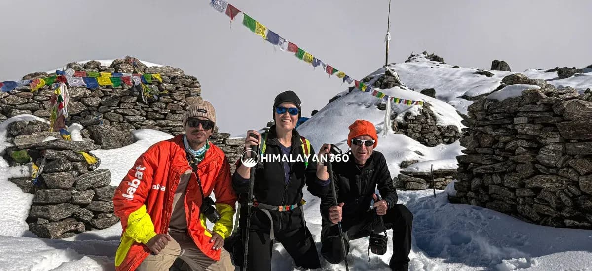
The Langtang Trek Route is a moderately difficult Himalayan trail with a round-trip distance of about 65 to 86 kilometers (40 to 53 miles). It is an “out-and-back” trail, meaning you return via the same path you ascended. It starts from Kathmandu and passes through Syabrubesi, Lama Hotel, Langtang Village, and Kyanjin Gompa before retracing the same trail back to the starting point.
This route also includes important elevation points and protected zones inside Langtang National Park, which covers about 1,710 sq km of central Nepal. Major altitude points are Lama Hotel (2,470M), Ghodatabela (3,030M), Langtang Village (3,430M), and Kyanjin Gompa (3,870M), which is the highest permanent settlement on the trail. The upper valley is surrounded by Langtang Lirung (7,227M) and Gangchempo (6,387M), whereas the lower area is mostly covered by forests, riverbanks, and moraine zones, with no major road expansion beyond Syabru Besi.
Overview of the Langtang Trek Route
| Section | Details |
|---|---|
| Starting Point | Kathmandu |
| Ending Point | Kathmandu |
| Duration | 8 to 10 days |
| Max Altitude | 3,870M (Kyanjin Gompa) or up to 4,984M (Tserko Ri viewpoint) |
| Avg Walking Hours | 5 to 7 hours per day |
| Difficulty | Moderate |
| Accommodation | Local teahouses and mountain lodges |
| Best Seasons | Spring (Mar–May) and Autumn (Sept–Nov) |
Langtang Trek Map: The Shape of the Trekking Route
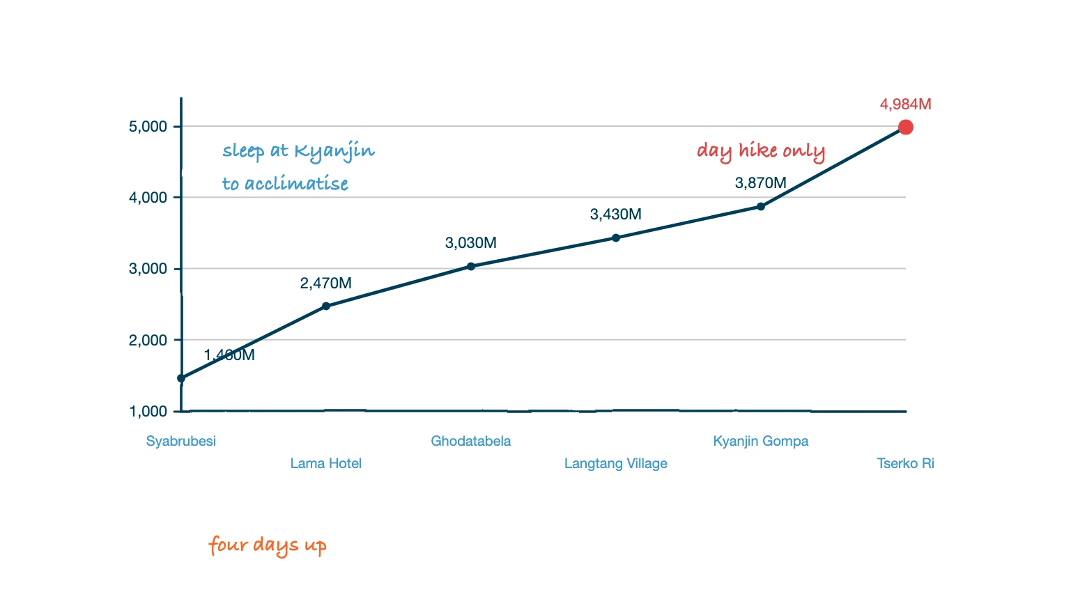
The Langtang Valley trek route is a single out-and-back line up one valley, which is what makes it easy to picture before you ever open a Langtang trek map. From a hotel in Kathmandu you drive north out of the Kathmandu valley to Syabrubesi, walk east up the Langtang Khola for three days to Kyanjin Gompa, spend a day on the ridges above the village, then retrace the same valley trail down. There is no loop, no committing pass and no second road out, so a Langtang valley trek map amounts to the river with the overnight stops marked along it.
Above the valley floor the skyline is dominated by the Langtang Himalayas. The Langtang range runs east from Langtang Lirung (7,227M), the mountain that stands over Langtang Village, past Langtang Ri to the Tibetan border, and Gangchempo and Dorje Lakpa close the eastern end. Almost the entire trekking route passes through Langtang National Park, so from the checkpoint at Dhunche onward you are walking inside a protected area with the Langtang Himalayan range on three sides. No other trek in Nepal puts a wall of 6,000M and 7,000M peaks this near the Kathmandu valley, which is the whole argument for a trek to Langtang rather than a flight to somewhere further away.
Spring and autumn are the two seasons with dry trails and clear air, but the valley is walkable year round with the right kit. The best time to trek, month-by-month temperatures, rainfall and season packing lists are all in our guide to weather in Langtang.
Why the Langtang Trek Route is Perfect for First-Time Himalayan Trekker?
The Langtang Valley Trek is one of the best beginner-friendly Himalayan treks due to its balanced topography, manageable altitude profiles, and straightforward navigation. Here are some reasons why it is suitable for beginners:
- Short and Manageable Duration: The full trek can be completed in 8–10 days, including travel from Kathmandu.
- Lower Altitude Risk: The main destination, Kyanjin Gompa (3,870M), is lower than many other Himalayan treks.
- Simple Route Navigation: The trail follows a single valley, and the same route is used for both ascent and descent.
- No Domestic Flights Required: The trek starts with a direct drive from Kathmandu to Syabrubesi.
- Good Teahouse Facilities: Local lodges provide meals, warm blankets, and basic accommodation throughout the trek.
- Less Crowded Trails: It offers a more peaceful trekking experience compared to Everest Base Camp or Annapurna.
- Optional High-Altitude Hikes: Side trips like Kyanjin Ri or Tserko Ri can be added for stronger trekkers.
Day-by-Day Langtang Valley Trek Itinerary
| Day | Route | Altitude | Duration | Difficulty | Highlights |
|---|---|---|---|---|---|
| 1 | Drive from Kathmandu to Syabrubesi | 1,460M | 6 hours drive | Easy | Scenic drive along the Trishuli River, Dhunche hills, |
| 2 | Trek from Syabrubesi to Lama Hotel | 2,470M | 6 hours | Moderate | Bamboo forests, suspension bridges, Langtang Khola river |
| 3 | Trek from Lama Hotel to Langtang Village | 3,430M | 6–7 hours | Moderate | Ghodatabela, views of Langtang Lirung, Tamang settlements |
| 4 | Trek from Langtang Village to Kyanjin Gompa | 3,870M | 3–4 hours | Moderate | Kyanjin Gompa monastery, Langtang Glacier, views of Gangchempo and Dorje Lakpa |
| 5 | Exploration Day at Kyanjin Gompa (Kyanjin Ri or Tserko Ri hike) | 4,773M – 4,984M | 4–7 hours | Challenging | Sunrise views from Kyanjin Ri or Tserko Ri, Langtang Lirung, Yala Peak, Langshisa Ri, |
| 6 | Trek back from Kyanjin Gompa to Lama Hotel | 2,470M | 7 hours | Moderate | Long downhill walk through the Langtang Valley |
| 7 | Trek back from Lama Hotel to Syabrubesi | 1,460M | 5 hours | Easy to Moderate | Riverside trails beside the Langtang Khola, bamboo forests |
| 8 | Drive back from Syabrubesi to Kathmandu | 1,400M | 6 hours drive | Easy | Return journey |
The first and last days are drives rather than walks. Kathmandu to Syabrubesi is roughly 120KM on the Pasang Lhamu Highway and takes 6 to 8 hours by bus or jeep, with the park checkpoint at Dhunche on the way. Fares, departure times and road conditions are covered in Kathmandu to Syabrubesi route and distance.
This is the standard Langtang trek itinerary, and almost every agency sells a version of the same 8 day trekking itinerary. What the table cannot show is how each day of the trek actually feels, so here is the same walk leg by leg.
Kathmandu to Syabrubesi
The drive north is the whole of day one. You leave the hotel in Kathmandu early, climb out of the Kathmandu valley, drop to the Trishuli and follow it up to Dhunche, where park staff check the permits, before descending the last stretch to Syabrubesi at 1,460M. Nothing is walked on this day, but it sets the pattern for the trek: everything on this route arrives by road.
Syabrubesi to Lama Hotel
The first walking day crosses the Langtang Khola on a suspension bridge and turns east into the gorge. It is around six hours of steady climbing through bamboo and oak to Lama Hotel at 2,470M, and it is the steepest sustained ascent of the whole route. Langtang trekking trail signs are minimal here because the valley leaves no room to go wrong: the river is on one side and the hillside on the other.
Lama Hotel to Langtang Village
The second walking day is the one that opens up. The forest thins above Ghodatabela at 3,030M, the valley widens, and Langtang Lirung appears at the head of it. You reach Langtang Village at 3,430M after six to seven hours, and the last hour crosses the debris field left by the 2015 avalanche before arriving at the rebuilt settlement.
Langtang Village to Kyanjin Gompa
This is the shortest walking day on the Langtang valley trail, three to four hours through yak pasture, mani walls and moraine to Kyanjin Gompa at 3,870M. The short stage is deliberate. It keeps the altitude gain small before the acclimatisation day and leaves the afternoon free to explore the Langtang and Kyanjin Gompa surroundings on foot.
Kyanjin Gompa and the Ridges Above It
The exploration day is what most people came for. From the village you can climb Kyanjin Ri at 4,773M in a morning, or make the longer trek to Tserko Ri at 4,984M, which takes four to seven hours round trip and is the highest point reached on the standard route. Either hike returns to the same lodge, so you carry nothing but a day pack.
Back Down the Valley to Kathmandu
The descent reverses the ascent: Kyanjin Gompa to Lama Hotel in about seven hours, Lama Hotel to Syabrubesi in about five, then the drive back to Kathmandu. Going down is faster but harder on the knees, and most trekkers complete the trek in eight days including both road days.
Langtang Trek Route Variants & Extensions
The Langtang Trek can be extended with several side trips and alternative routes for trekkers who want a longer Himalayan experience. Popular extensions are the Gosaikunda Lake Trek, the Tamang Heritage Trail, and the Helambu region trek. These route variations are described clearly below:
Langtang Gosaikunda Trek
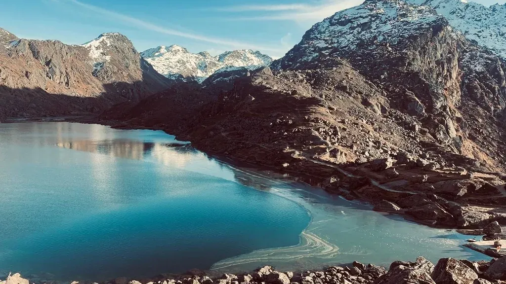
The Langtang Gosaikunda Trek is an extended version of the classic Langtang Valley Trek that combines the glacier landscapes of Langtang with the alpine lakes of Gosaikunda. After exploring Kyanjin Gompa, the route descends to Lama Hotel and then separates toward Thulo Syabru before climbing into the high mountain region of Gosaikunda. This extension adds more high-altitude passes, and spiritual landmarks than the standard Langtang Trek.
- Duration: 13–16 days
- Cost: USD 659–1,099
- Difficulty: Moderate to Challenging
- Trek Distance: 152.8KM
- Highest Point: Lauribina Pass (4,610M)
Gosaikunda is a complex of 108 lakes at 4,380M and a pilgrimage site for Hindus and Buddhists alike, which is worth understanding before you walk up to it. The background is in why Gosaikunda Lake is sacred.
Tamang Heritage Trail
The Tamang Heritage Trek is a cultural extension of the Langtang region trek that focuses more on traditional mountain communities than high-altitude scenery. Instead of following the main Langtang Valley route directly after Syabrubesi, the trail diverts west toward villages such as Gatlang, Tatopani, Thuman, and Briddim before reconnecting with the Langtang route near Syabrubesi. Compared to the standard Langtang Trek, the Tamang Heritage Trail stays at lower elevations, which reduces the risk of altitude sickness.
- Duration: 6–8 days
- Cost: USD 360–460
- Difficulty: Easy
- Trek Distance: 58.9KM
- Highest Point: Nagthali Viewpoint (3,165M)
Langtang–Helambu Circuit
The Langtang–Helambu Circuit is a longer trekking variation that creates a continuous north-to-south Himalayan route. After reaching Kyanjin Gompa in the Langtang Valley, trekkers will return to Lama Hotel and then diverge southward toward Thulo Syabru or Ghopte, eventually entering the Helambu. Compared to the standard Langtang Trek, this route provides higher overall elevation gain and a complete north-to-south journey through the Langtang National Park region.
- Duration: 8–14 days
- Cost: USD 400-600
- Difficulty: Moderate to Challenging
- **Trek Distance:**120–140KM
- Highest Point: Lauribina La Pass (4,610M)
Major Attractions Along the Langtang Trek Route
The Langtang Trek Route is famous not only for its mountain views but also for its wildlife, Himalayan culture, and beautiful alpine scenery. The main stops on the walking route are described below, and the wider regional list, including Gosaikunda, Nagthali and the Helambu villages, is in major attractions in the Langtang region.
Langtang National Park
Established in 1976, Langtang National Park is the first Himalayan national park of Nepal. The park covers around 1,710 sq km across the Rasuwa, Nuwakot, and Sindhupalchok districts. The trail begins in warm river valleys below 1,500 m and climbs into alpine terrain above 4,000M. The park is also known for its biodiversity and rare Himalayan wildlife.
Lower sections of the trail pass through forests of oak, bamboo, pine, silver fir, and more than 15 species of rhododendron that bloom during spring. These forests also provide a habitat for rare animals such as the Red Panda, Himalayan Thar, musk deer, Himalayan black bear, and grey langur monkeys. Higher rocky regions are home to snow leopards, while the park also protects more than 250 bird species, including the colorful Himalayan Monal, Nepal’s national bird.
Traditional Tamang Villages and Local Culture
The Langtang region is home to several old Tamang settlements such as Bridhim, Thuman, Langtang Village, and Syabru Besi. Many houses are built using locally cut stone, wooden beams, and packed mud roofs designed for cold Himalayan weather.
Religion is closely connected with Tibetan Buddhism. Long Mani walls sculpted with Buddhist prayers, white Chortens, and colorful Lungta prayer flags appear in the major walking routes of the trail. Local people are engaged in agro-pastoral work such as yak and chauri herding, sheep wool spinning, and high-altitude farming of barley, potatoes, and buckwheat, which have been followed in the region for generations.
Langtang Village
Located at an altitude of 3,430m, Langtang Village is one of the most important settlements in the Langtang Valley. The village became internationally known after the April 2015 earthquake, when a massive avalanche from Langtang Lirung buried the original settlement under rock, ice, and snow.
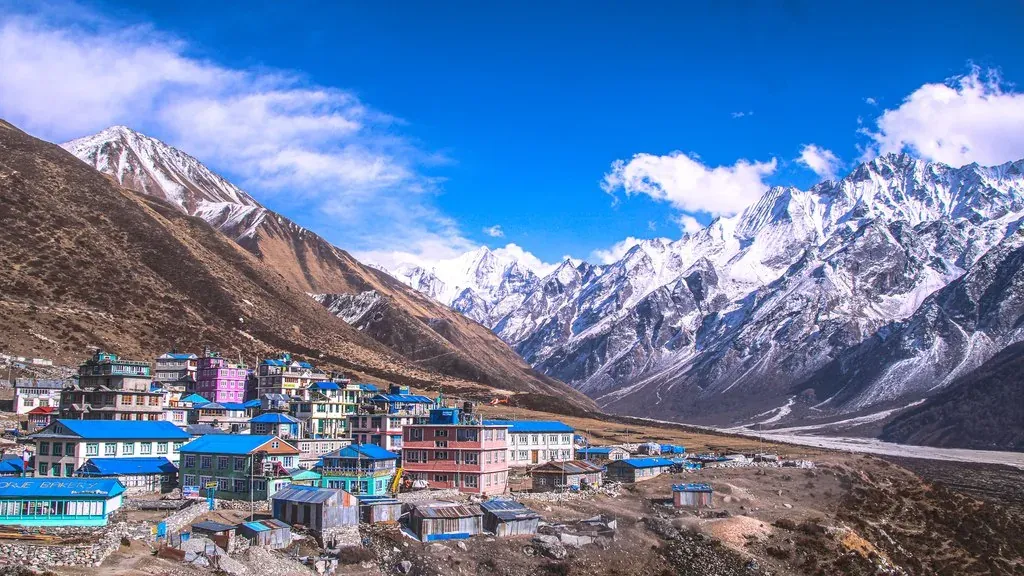
More than 300 people lost their lives in the disaster, including local residents, trekking guides, and foreign visitors. Today, the rebuilt village is located slightly away from the old site and represents the recovery and determination of the local Tamang community. The full account of what stood there before 2015 and what has been rebuilt since is in Langtang Village before and after the earthquake. Despite its painful history, Langtang Village has once again become an active trekking stop with rebuilt lodges, farming fields, and local yak shelters.
Kyanjin Gompa
Kyanjin Gompa is the highest overnight stop and the final main settlement of the Langtang Trek. The village is located in the upper Langtang Valley beneath Himalayan peaks such as Langtang Lirung (7,227M), Yubra Himal (6,035M), and Langshisa Ri (6,427M). At the center of the settlement is the old Kyanjin Monastery, built in traditional Tibetan style.
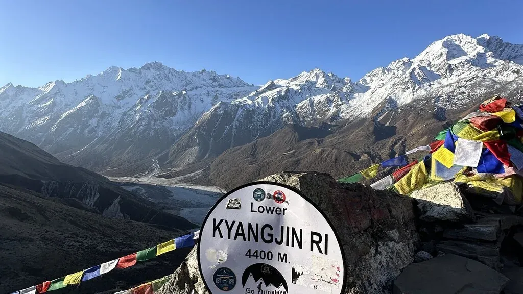
Kyanjin Gompa is also known for its yak cheese factory, which was established in 1955 with Swiss technical support. It is one of the oldest high-altitude cheese production centers in Nepal and still produces yak cheese using milk collected from alpine grazing areas. Due to its high elevation and open terrain, Kyanjin Gompa is also the main base for side hikes toward Kyanjin Ri (4,773M) and Tserko Ri (4,984M).
Tserko Ri Viewpoint
Tserko Ri (4,984M) is the highest viewpoint reached on the standard Langtang Trek Route. The trek to Tserko Ri starts from Kyanjin Gompa and takes around 4 to 6 hours round-trip. Unlike technical climbing peaks, Tserko Ri can be reached without ropes or mountaineering equipment, although the steep altitude gain makes the climb challenging.
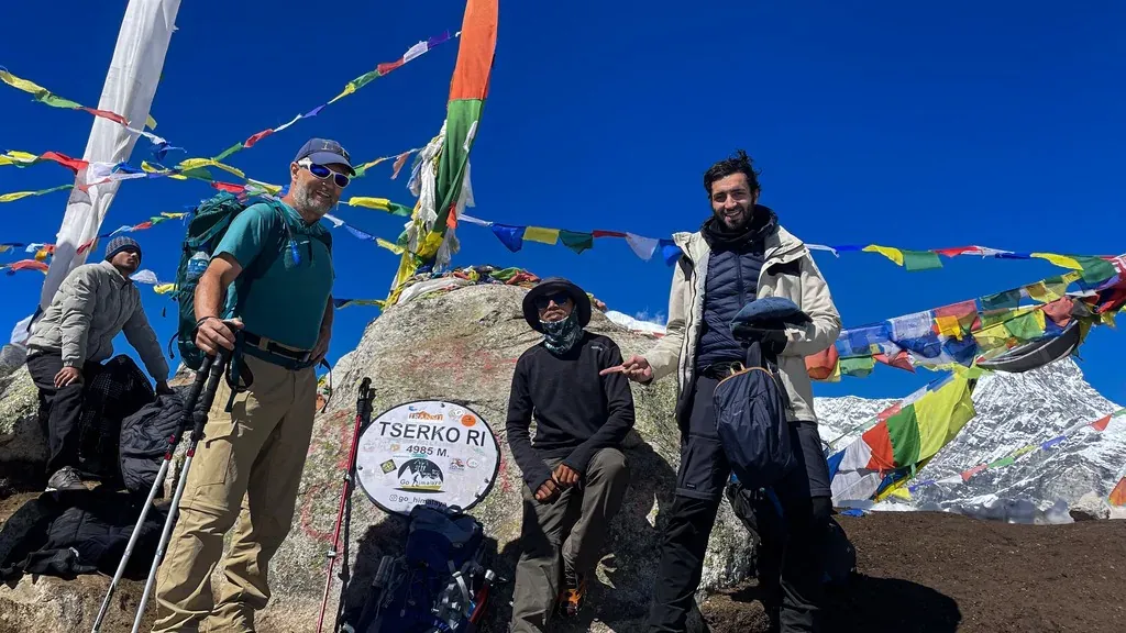
From the top, trekkers will receive a beautiful mountain view of Langtang Lirung (7,227M), Gangchempo (6,387M), Naya Kanga (5,844M), Yala Peak (5,500M), and Dorje Lakpa (6,966M). Sometimes, Shishapangma (8,027M) in Tibet can also be seen in the far northern skyline.
Difficulty Level of the Langtang Trek
The Langtang Trek is a moderate-level Himalayan trek. It is more challenging than short hill hikes near Kathmandu but easier than longer high-altitude routes such as the Everest Base Camp Trek or the Annapurna Circuit. The highest overnight stop is Kyanjin Gompa (3,870M), which is below the extreme altitude zone. Therefore, the route is suitable for first-time trekkers with basic fitness and good walking stamina.
The main difficulty comes from continuous uphill and downhill walking on stone steps. The climb from Syapru Besi to Lama Hotel is one of the steepest sections of the route, while the return descent can place heavy pressure on knees and leg muscles. Temperatures also change sharply with altitude, as lower sections are warm and humid, while areas above Langtang Village fall below freezing during the night.
Langtang Trek Permits: Complete 2026 Guide
You must have a Langtang National Park Entry Permit before entering the trail. They are issued per continuous entry and cannot be purchased online. Your licensed trekking agency will process these on your behalf using scanned copies of your passport. Here’s a detail cost breakdown:
| Permit Type | Cost for Foreign Nationals | Cost for SAARC Nationals | Cost for Nepali Citizens |
|---|---|---|---|
| Langtang National Park Entry Permit | NPR 3,000 | NPR 1,500 | NPR 100 |
| TIMS Card | NPR 1,000 (blue) | NPR 600 (pink) | |
| Shivapuri Nagarjun Entry Permit (only if you start or finish through Helambu) | NPR 500 | NPR 100 | NPR 50 |
That comes to about NPR 4,000, roughly USD 30, for a foreign trekker on the standard Syabrubesi route. Permits are checked at Dhunche, Syabrubesi and Ghodatabela, and both documents stay valid for one month from the date of issue. The application documents, the rules and the penalties for trekking without them are set out in our Langtang Valley trek permit guide.
Trekking Guide Rules: Can You Trek the Langtang Valley Independently or Without a Guide?
No. Since February 17, 2025, every trekker on the Langtang route, foreign or Nepali, must be accompanied by a licensed trekking guide arranged through a registered agency. Neither the park entry permit nor the TIMS card is issued to a trekker without one, so there is no way to trek the Langtang valley independently, whatever an older guide to the Langtang valley still says. The decision is no longer independently or with a guide; it is which guide for the Langtang route you hire. If you were planning to trek independently and carry your own pack, the part of that plan you keep is the pack, not the permit.
Trekking with a guide and hiring a porter are two separate decisions. The guide is compulsory and the porter is not. A guide or agency handles the permits, the checkpoints and any evacuation call, and when you hire a guide you can add a guide or porter through the same agency at the same time. Deciding between a guide and porter together or a guide alone is mostly a question of what you are willing to carry up the climb to Lama Hotel, since that stage is where most people wish they had made the other choice. Whether you walk in a private pair or a guide or group departure changes the price rather than the route.
A separate 2026 update is often confused with this rule. On March 22, 2026, Nepal’s Department of Immigration removed the requirement for a minimum of two foreign trekkers in a group applying for restricted area permits, which covers the 15 restricted regions such as Upper Mustang, Manaslu and Dolpo. Langtang is not a restricted area, so that change does not alter anything here. A licensed guide and agency registration remain compulsory either way.
Cost Breakdown for the Langtang Trek
The Langtang Trek is considered one of the most affordable Himalayan treks in Nepal because it does not require expensive domestic flights like the Everest Base Camp Trek. The overall cost of the Langtang valley walk depends on transport choice, guide services, accommodation style, and trekking duration. A booked trek package rolls the permits, guide, transport and lodging into one figure, while trekking in the Langtang valley on a self-organised basis means paying each line separately at the going teahouse rate.
| Expense | Cost (USD) |
|---|---|
| Permits | 20 –40 |
| Transport | 20 –120 |
| Accommodation | 30 – 60 |
| Food and Water | 165 – 280 |
| Guide | 250–350 |
| Porter (Optional) | 140–210 |
| Miscellaneous Tips (Doesn’t include inside package) | 40 – 100 |
| Total Estimate | 449-1,000 |
Food and Accommodation on the Langtang Valley Trek
Food on the Langtang Trek is local, hygienic, and are cooked to provide enough energy for long walking days. The most common meal is Dal Bhat, which includes rice, lentil soup, vegetable curry, and pickles, and many teahouses offer free rice and dal refills. Menus also include foods like chow mein, fried rice, momos, pasta, pancakes, potatoes, soups, and egg dishes.
Accommodation on the Langtang valley route is provided through family-run teahouses and mountain lodges, and the lodges are close enough together that you never have to reach Langtang Village or any other single stop to find a bed. Rooms are very normal twin-sharing spaces with wooden beds, foam mattresses, pillows, and thick blankets. Heating is available only in the dining hall, while bedrooms are almost cold at night above Langtang Village, where temperatures fall below freezing.
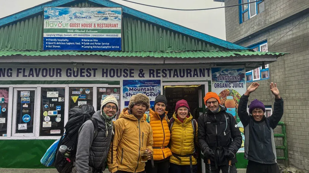
Shared bathrooms are common in upper sections of the trek, and extra services such as hot showers, Wi-Fi, and phone charging require additional payment ranging from NPR 150 to 500.
Why Choose Langtang Over Everest or Annapurna for Your First Trek in Nepal?
The Langtang Trek is a popular choice for trekkers looking for a real Himalayan trekking experience without the large crowds, high costs, or long duration of the Everest and Annapurna regions. Another major advantage is that the trek starts with a road journey from Kathmandu, so there is no need for domestic flights, which reduces both travel expenses and flight delays. Let’s go through the table for clearer information.
| Feature | Langtang | Everest | Annapurna |
|---|---|---|---|
| Crowd Level | Low to moderate | Very high | Very high on popular routes |
| Cost | USD 449–1,000 | USD 1,260–2150 | USD 666-1,317 |
| Duration | 8–10 days | 14 days | 9–14 days |
| Accessibility | Direct drive from Kathmandu | Requires a flight to Lukla | Drive or flights |
| Altitude Risk | Moderate (max 3,870M) | High (up to 5,535M) | High (up to 5,416M) |
| Cultural Experience | Tamang culture | Sherpa culture | Mixed Gurung, Thakali, Tibetan Buddhism |
Conclusion
The Langtang Trek route is no longer just a path of recovery, it is a symbol of strength and rebuilding. By choosing this trek, you support a local community that has rebuilt its homes and life after major loss, while exploring one of the most accessible high-altitude landscapes in the world.
What you really need to know about the Langtang trek is that a Langtang valley trek in Nepal asks less of you than any other trek in Langtang's altitude class. Trekking Langtang valley on the standard route means eight days to explore the Langtang valley from its warm lower gorge to the moraine at its head, and a trek in the Langtang region is the rare Himalayan walk you can start the morning after you land. The best Langtang itinerary for most people is the standard eight days, and you can plan your Langtang valley trek around a single fortnight without booking a domestic flight.
If you are ready to see glaciers and mountains up close, we can take care of permits and travel arrangements so you can focus on the trek itself.
 Trek
Trek By air
 Pilgrimage
 Festivals
 Wildlife
 Luxury
 Yoga
Yoga Food
Food Heritage