Manaslu Tsum Valley Trek

Destination

Nepal, Manaslu Region

Max. Altitude

5,106m/16,752ft

Difficulty

Strenuous

Best Season

Mar, Apr, May, Sep, Oct, Nov

Transportation

Bus, Car, Jeep

Start / End

Kathmandu/Kathmandu

Accommodation

Tea house

Meals

Breakfast, Lunch, Dinner

Travel Distance

197.7KM/ 122.8Miles

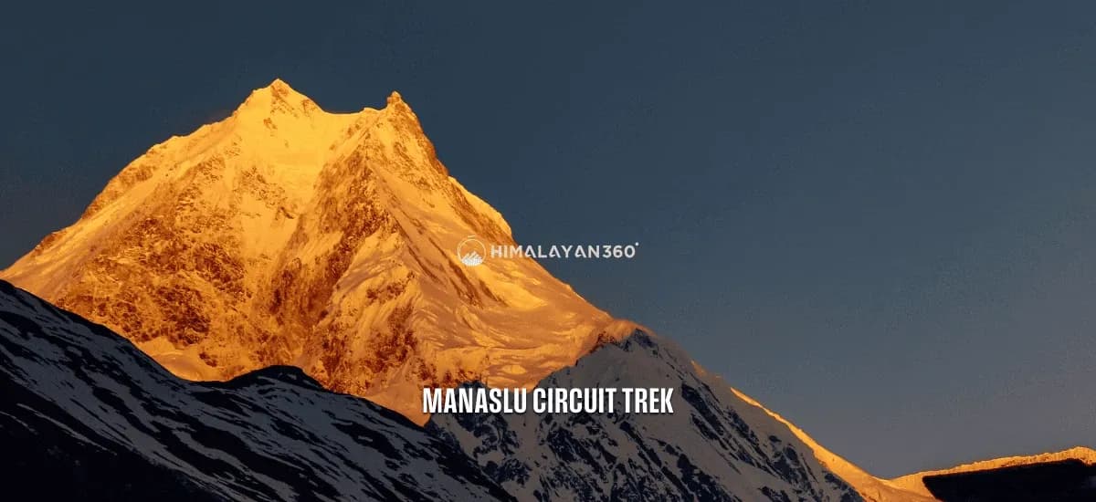
The Manaslu Tsum Valley Trek is an adventure around Mount Manaslu, the world’s eighth-highest peak at 8,163 meters (26,781 feet). This trek takes you through the scenic Manaslu Conservation Area and into the remote Tsum Valley, close to the Tibetan border. For 20 days, trekkers travel through serene pine forests, rhododendron jungles, and challenging trails leading up to the Larkya La Pass with majestic mountain views. The trek features high-altitude lakes, unique wildlife, and ancient Buddhist monasteries, with altitudes above 3,000m and 5,000m (16,404 feet) respectively.

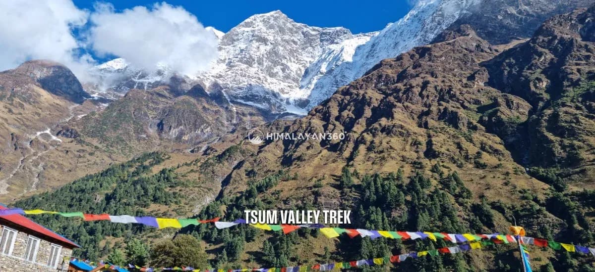
Along the way, you’ll discover a rare blend of Nepali and Tibetan culture, language, and traditions that make this region truly special. You will climb through Gurung villages with rice and millet terraces and cross many Buddhist shrines, especially in the Tsum Valley, which also has a similar culture to Tibetans. Tsum Valley, located near the Tibetan border, offers opportunities to encounter Buddhist monks and explore Milarepa’s Cave. You can also view Nepal’s national bird, the Lophophorus, against majestic landscapes of Mount Manaslu and Himalayan ridges like Hiunchuli and Annapurna II. The Manaslu Tsum Valley trek is ideal for adventure-seekers, but beginners with strong bodies and amazing stamina can also experience this. Just make sure that you are physically fit, if you are planning to take up the trek.

Per Person From

$1,330

20 Days

Experts for help

Ask our travel experts about customising this trip.
Build Your Custom Trip

Per Person From$1,33020 Days

Major Highlights of Manaslu Tsum Valley Trek

  • Follow an old path that was once used for trading with Tibet.
  • Explore Milarepa Piren Phu Cave, a very holy cave in Tsum Valley.
  • Cross the high Larkya La Pass, one of the longest passes in the Himalayas.
  • Experience the interesting mix of Tibetan Nupri and Gurung cultures.
  • See amazing views of glaciers, lakes, rocks, and mountains like Manaslu, Himchuli, and Ganesh near the Tibet border.
  • Walk on trails that are not too crowded.
  • Walk around the base of Mount Manaslu, the eighth-highest mountain in the world.
  • Take optional day trips to Birendra Lake, Punhyen Glacier, or Manaslu Base Camp from Samagaun.
  • See Dephyudonma and Rachen monasteries, the oldest ones in the Tsum Valley.
  • Discover old Buddhist stupas, monasteries, and the traditional Tibetan way of life.
  • Enjoy a beautiful drive from Kathmandu to the starting point at Soti Khola.
  • Visit the Mu and Lungdang Gompa, essential monasteries in the Tsum Valley.

Manaslu Tsum Valley Trek at a Glance

Distance, walking time and high point for each day
DayItineraryDistance / TimeAltitude
01Arrival at Tribhuvan International Airport in Kathmandu and transfer to hotel (1,400m/4,593ft)1,400 m
02Trek Briefing and Preparation of Manaslu Restricted Area Permit
03Kathmandu to Machha Khola (930m/3,051ft)road transfer150 km9 hrs1,400 m
04Machha Khola to Jagat (1,410m/4,626ft)22 km7 hrs1,410 m
05Jagat to Lokpa (2,240m/7,349ft)17 km7 hrs2,240 m
06Lokpa to Chumling (2,386m/7,828ft)6.3 km5 hrs2,386 m
07Chumling to Rachen Gompa (3,240m/10,630ft)10.5 km6 hrs3,240 m
08Rachen Gompa to Nile (3,360m/11,024ft) and to Mu Gompa (3,700m/12,139ft), then back to Nile12.4 km7 hrs3,700 m
09Nile to Chumling (2,386m/7,828ft)15 km6 hrs3,360 m
10Chumling to Deng (1,860m/6,102ft)12 km7 hrs2,386 m
11Deng to Namrung (2,660m/8,727ft)19 km7 hrs2,660 m
12Namrung to Lho (3,180m/10,433ft)11.2 km6 hrs3,180 m
13Lho to Samagaon (3,530m/11,581ft)7 km4 hrs3,530 mSamagaon
14Rest day in Samagaon: Hiking to Birendra Lake or Manaslu base camp5 km3 hrs3,530 mSamagaon
15Samagaon to Samdo (3,690m/12,106ft)8.5 km4 hrs3,690 m
16Samdo to Larkya Phedi (4,470m/14,665ft)6 km4 hrs4,470 mLarkya Phedi
17Larkya Phedi to Bimthang (3,720m/12,205ft) via Larkya La Pass (5,106m/16,752ft)24.8 km9 hrs5,106 m
18Bhimtang to Dharapani (1,820m / 5,971ft)21 km8 hrs3,720 m
19From Dharapani, to Besisahar (760m / 2,493ft), then back to Kathmandu/Pokhara.road transfer220 km9 hrs1,820 m
20Transfer to the International Airport for your Final Departure
On foot, across 18 trekking days197.7 km90 hrs5,106 m

Reviews from our Guests

From travellers who walked this exact itinerary.

★★★★★

We spent nine days in the valley and passed very few other groups. Gumba Lungdang was the most atmospheric place I stayed anywhere in Nepal, perched on a hillside with nothing around it. The walking is steady rather than brutal. Bring warm layers because the stone buildings hold the cold and the evenings get sharp quickly once the sun goes.

SD
Sophie DelacroixMay 2026
★★★★★

Below Chumling it still feels like ordinary Nepal. Above it, the architecture changes, the faces change, and you are clearly somewhere with a Tibetan history. Anjan explained the difference between the two gompas and why Tsum was closed for so long. The trail is not technically hard but the days are long and the first section from Machha Khola is hot and dusty.

NP
Nisha PradhanApril 2026 · Guided by Anjan Bikram Thapa
★★★★★

If you have three weeks, doing Tsum and the circuit together makes much more sense than either alone. You get the hidden valley and then the high pass, and you only do the hot lower section once. Machha Khola to Jagat is the least interesting part and after that it improves every day. Well run trip, good food, honest briefing about what the conditions would be.

YN
Yuki NakamuraMarch 2026
★★★★★

You need a restricted area permit and a licensed guide for Tsum, which puts some people off. It should not. The permit is exactly why the valley is not overrun. The team sorted all of it before we left Kathmandu and I did not have to think about it. Chumling and Nile were highlights and the whole thing felt like proper old fashioned trekking.

CW
Callum WrightNovember 2025
★★★★★

Adding the Manaslu circuit to Tsum makes it a long trip but the two halves complement each other well. Tsum is about culture and the circuit is about the pass. Larke La was cold and windy and the descent afterwards is long, but coming over with Manaslu behind you is a proper finish. Nabaraj watched the weather closely and moved our crossing forward by a day, which turned out to be the right call.

DK
Daniel KrugerOctober 2025 · Guided by Nabaraj Simkhada
★★★★★

Tsum is a hidden valley in the real sense, closed to outsiders until recently and still feeling that way. Walking up to Mu Gompa near the Tibetan border with the wind going through the prayer flags is something I will not forget. The nuns at Rachen Gompa let us sit in during prayers. This is a cultural trek as much as a mountain one and I went home thinking about the people more than the peaks.

LA
Lars AndersenOctober 2025

Manaslu Tsum Valley Trek Day By Day Itinerary

Download this itinerary

Day 01: Arrival at Tribhuvan International Airport in Kathmandu and transfer to hotel (1,400m/4,593ft)

Itinerary Details
Itinerary FactDetails
Highest Altitude:1,400m/4,593ft

Place: Thamel

On the first day of the Manaslu and Tsum Valley Trek, you will arrive in Kathmandu. Our representative will meet you at the airport and take you to the hotel. In the evening, they will explain the plan for your stay and introduce you to the crew. You will spend the night at the hotel in Thamel.

Itinerary Details
Itinerary FactDetails
Accommodation:3 Star Hotel

Day 02: Trek Briefing and Preparation of Manaslu Restricted Area Permit

Place: Thamel

Day two of the Manaslu Tsum Valley Trek is dedicated to crucial pre-trek arrangements in Kathmandu. Your trekking agency and guide will give you a comprehensive briefing, during which the itinerary, safety guidelines, local customs, and essential information about the trek will be thoroughly explained. This will allow you to ask any questions and feel well-prepared.

Our trekking agency will also complete the paperwork for your Manaslu Restricted Area Permit (MRAP) and the Tsum Valley Restricted Area Permit. To get these permits, you need to provide your original passport, visa details, passport-sized photos, and proof of travel insurance. These permits are required to enter these protected areas and can only be obtained through a registered trekking company.

Itinerary Details
Itinerary FactDetails
Meals:Breakfast
Accommodation:3 Star Hotel

Day 03: Drive from Kathmandu to Machha Khola (930m/3,051ft)

Itinerary Details
Itinerary FactDetails
Time:06-15
Travel Duration:9 hours
Travel Distance:150km/93 miles
Highest Altitude:1,400m/4,593ft (Kathmandu)

Place: Machha Khola

The third day of the Manaslu circuit and Tsum Valley trek begins with breakfast in Kathmandu. Today, we will leave the capital and reach Maccha Khola. The journey to Maccha Khola is long and can be uncomfortable due to bumpy roads. The jeep offers more comfort and flexibility, while the bus is a cheaper option, although it is less restful.

Depending on your chosen vehicle, reaching the first overnight stop takes about 7 to 9 hours. The last few hours will be over a rough road. After reaching Maccha Khola, you will enter your hotel for dinner and overnight stay.

Itinerary Details
Itinerary FactDetails
Meals:Breakfast, Lunch, and Dinner
Accommodation:Tea House or Lodge

Day 04: Trek from Machha Khola to Jagat (1,410m/4,626ft)

Itinerary Details
Itinerary FactDetails
Time:08-15
Trek Distance:22km/13.6 miles
Ascent:540m/1,772ft
Descend:60m/197ft
Trek Duration:7 hours
Highest Altitude:1,410m/4,626ft (Jagat)

Place: Jagat

Today’s Manaslu Tsum Valley journey begins by following the Budhi Gandaki River upstream. After crossing the Tharo Khola, you walk alongside steep cliffs, waterfalls, and rocky gorges. You will also walk through occasional landslide-prone areas. You will then pass through the small settlement of Kholabesi before reaching Tatopani, a natural hot spring where you can dip your feet or relax for a moment.

Continuing onward, you will cross a suspension bridge over the Budhi Gandaki, pass through the village of Dobhan, and climb up a stone staircase to Thado Bharyang. From here, the final stretch takes us uphill to Jagat. Jagat is a beautiful stone-paved village and the official gateway to the Manaslu Conservation Area. We’ll register our permits at the checkpoint here. Overnight stay at a teahouse in Jagat.

Itinerary Details
Itinerary FactDetails
Meals:Breakfast, Lunch, and Dinner
Accommodation:Tea House or Lodge

Day 05: Trek from Jagat to Lokpa (2,240m/7,349ft)

Itinerary Details
Itinerary FactDetails
Time:08-15
Trek Distance:17km/10.6 miles
Ascent:900m/2,953ft
Descend:70m/230ft
Trek Duration:7 hours
Highest Altitude:2,240m/7,349ft (Lokpa)

Place: Lokpa

Today marks our entry into the restricted Tsum Valley region. After a short climb up to Salleri, you’ll walk along scenic riverbanks and cross the Budhi Gandaki on a long suspension bridge. The trail gradually opens up as we head toward Philim.

At Ekle Bhatti, the trekking route splits. One continues along the Manaslu Circuit, and the other diverts to Tsum Valley. We take the right-hand trail that ascends through dense forest and narrow gorges toward Lokpa, the first village in Tsum Valley. Lokpa offers some of the first wide-angle views of Himalchuli and Boudha Himal. This hidden valley is said to have been blessed by Padmasambhava, the great tantric master who introduced Buddhism to Tibet. Overnight stay at a lodge in Lokpa.

Itinerary Details
Itinerary FactDetails
Meals:Breakfast, Lunch, and Dinner
Accommodation:Tea House or Lodge

Day 06: Trek from Lokpa to Chumling (2,386m/7,828ft)

Itinerary Details
Itinerary FactDetails
Time:08-13
Trek Distance:6.3km/3.9 miles
Ascent:186m/610ft
Descend:40m/131ft
Trek Duration:5 hours
Highest Altitude:2,386m/7,828ft (Chumling)

Place: Chumling

The trek ahead starts getting tougher from the sixth day of your Manaslu Tsum Valley trek. As you move forward, you will see beautiful sights like a deep gorge, the Lungwa River valley, and forests of rhododendron, pine, and juniper. Ganesh Himal stands out as the tallest mountain. Also, there are no villages along the route, so you’ll be surrounded by untouched nature and its mesmerizing beauty throughout the trek.

After a final uphill push through thick pine and rhododendron forest, you will arrive at Chumling. Chumling is the first major village in the lower Tsum Valley area and is the gateway to the Upper Tsum Valley. Upon arrival, we can also visit two nearby Buddhist monasteries: Panago Gompa and Gurwa Gompa. Chumling has only a few simple houses, and since you will get here by lunchtime, it’s a great idea to explore these monasteries before settling down for the evening. Overnight stay at a local lodge in Chumling.

Itinerary Details
Itinerary FactDetails
Meals:Breakfast, Lunch, and Dinner
Accommodation:Tea House or Lodge

Day 07: Trek from Chumling to Rachen Gompa (3,240m/10,630ft)

Itinerary Details
Itinerary FactDetails
Time:08-14
Trek Distance:10.5km/6.5 miles
Ascent:854m/2,802ft
Descend:0m/0ft
Trek Duration:6 hours
Highest Altitude:3,240m/10,630ft (Rachen Gompa)

Place: Rachen Gompa

Starting from Chumling (2,386m/7,828ft), the trek to Rachen Gompa (3,240m/10,630ft) takes about 6-7 hours and involves a gradual climb. Along the way, you’ll enjoy beautiful views of the Himalayas, including the Ganesh Himal range. The trail passes through small villages, allowing you to see the culture and way of life of the Tsumba people, who are closely connected to Tibetan Buddhism.

When you reach Rachen Gompa, a significant Buddhist nunnery established in 1936, you can explore its detailed murals, ancient Buddhist texts, and the calm spiritual environment created by the locals.

Itinerary Details
Itinerary FactDetails
Meals:Breakfast, Lunch, and Dinner
Accommodation:Tea House or Lodge

Day 08: Trek from Rachen Gompa to Nile (3,360m/11,024ft) and hike to Mu Gompa (3,700m/12,139ft), then back to Nile

Itinerary Details
Itinerary FactDetails
Time:08-15
Trek Distance:12.4km/7.7 miles
Ascent:460m/1,509ft
Descend:340m/1,115ft
Trek Duration:7 hours
Highest Altitude:3,700m/12,139ft (Mu Gompa)

Place: Nile

On your eighth day of your Manaslu Tsum Valley trek, the trek takes place from the peaceful Rachen Gompa and descends to Nile village. Nile is the last village in the Upper Tsum Valley. It sits on the west side of the Shiar Khola River. You will stop here for a bit to rest and enjoy the beautiful views.

After that, you will continue your hike towards Mu Gompa. Mu Gompa is one of the most sacred points of the Tsum Valley Trek. It offers a glimpse into the rich Buddhist heritage of the area and breathtaking views of the mountains. After exploring Mu Gompa and the surrounding region, you will return to the Nile for the night. This day will be filled with cultural experiences and a sense of awe for the spiritual hub of the upper Tsum Valley.

Itinerary Details
Itinerary FactDetails
Meals:Breakfast, Lunch, and Dinner
Accommodation:Tea House or Lodge

Day 09: Trek from Nile to Chumling (2,386m/7,828ft)

Itinerary Details
Itinerary FactDetails
Time:08-14
Trek Distance:15km/9.3 miles
Ascent:60m/197ft
Descend:1,034m/3,392ft
Trek Duration:6 hours
Highest Altitude:3,360m/11,024ft (Nile)

Place: Chumling

You will hike down from the Nile, the last village in the upper Tsum Valley, to Chumling in the lower Tsum Valley today. This trek usually takes about 6 to 7 hours and covers around 12 kilometers. Walking down, you will see the plants becoming greener and more varied.

You will leave behind the dry landscapes of the higher altitudes. The trail goes through forests and along the Siyar Khola river, giving you enjoyable views as you enter the lower Tsum region and reach the friendly village of Chumling, where you will stay overnight.

Itinerary Details
Itinerary FactDetails
Meals:Breakfast, Lunch, and Dinner
Accommodation:Tea House or Lodge

Day 10: Trek from Chumling to Deng (1,860m/6,102ft)

Itinerary Details
Itinerary FactDetails
Time:08-15
Trek Distance:12km/7.5 miles
Ascent:40m/131ft
Descend:626m/2,054ft
Trek Duration:7 hours
Highest Altitude:2,386m/7,828ft (Chumling)

Place: Deng

After leaving Chumling, you will have a long downhill walk to Lokpa village. The day 10 Manaslu Tsum Trek begins on a boulder hill where you can catch a glimpse of Sringi Himal in the distance. You will walk alongside the Shair Khola River, and the path will treat you to glorious views of Ganesh Himal, Manaslu, and other snow peaks surrounding the region.

Along the way, you will also pass over Ghatta Khola and trek through maize, millet, potato, and vegetable fields. Following the trek in a dry canyon, you will pass over a spot of bamboo forest to reach the Deng River and continue trekking along the bank of the Budhi Gandaki River to finally reach Deng village.

Itinerary Details
Itinerary FactDetails
Meals:Breakfast, Lunch, and Dinner
Accommodation:Tea House or Lodge

Day 11: Trek from Deng to Namrung (2,660m/8,727ft)

Itinerary Details
Itinerary FactDetails
Time:08-15
Trek Distance:19km/11.8 miles
Ascent:860m/2,822ft
Descend:0m/0ft
Trek Duration:7 hours
Highest Altitude:2,660m/8,727ft (Namrung)

Place: Namrung

The eleventh day of the Manaslu Tsum Valley Trek is again exciting as you continue to go downhill. Today, you are on the Manaslu Trekking trail again. You begin the day by climbing up and then descending to the Budhi Gandaki River. You’ll walk through several small villages like Gaap, Rana Gaon, and Bhiphedi.

One of the main highlights on this day will be the stunning view of Shyaula Peak. After several hours of walking, you will reach Namrung, which has the best tea shops and hotels. The village is beautiful and offers a magnificent view of hills and valleys.

Itinerary Details
Itinerary FactDetails
Meals:Breakfast, Lunch, and Dinner
Accommodation:Tea House or Lodge

Day 12: Trek from Namrung to Lho (3,180m/10,433ft)

Itinerary Details
Itinerary FactDetails
Time:08-14
Trek Distance:11.2km/6.9 miles
Ascent:520m/1,706ft
Trek Duration:6 hours
Highest Altitude:3,180m/10,433ft (Lho)

Place: Lhogaon

Today we will trek from Namrung to Lho. The trail climbs through a forest and passes barley fields and small villages like Lihi. From Lihi, you’ll get amazing views of Himal Chuli and Ganesh Himal. The trail then goes downhill to the Simnang Valley and crosses the Hinang River, where you can see the peak of Ngadi Chuli. After passing the village of Sho, the path climbs again through prayer wheels and forest trails. Finally, you will reach Lho.

Lho is a large and peaceful village on a ridge with stunning views of Manaslu mountain and the Naike Himal. In the evening, you can hike to a nearby viewpoint called Kani to watch the sunset over the mountains. The village also has a beautiful monastery called Ribung Monastery. If you wake up early, you can also enjoy the sunrise from Lho.

Itinerary Details
Itinerary FactDetails
Meals:Breakfast, Lunch, and Dinner
Accommodation:Tea House or Lodge

Day 13: Trek from Lho to Samagaon (3,530m/11,581ft)

Itinerary Details
Itinerary FactDetails
Time:08-12
Trek Distance:7km/4.3 miles
Ascent:350m/1,148ft
Trek Duration:4 hours
Highest Altitude:3,530m/11,581ft Samagaon

Place: Samagaon

Today’s trek from Lho to Samagaon is short and scenic. At first, you will pass through the peaceful village of Shyala. The views of Mount Manaslu are stunning throughout, which appear even more majestic as you get closer to Samagaon. You’ll reach the Samagaon village by lunchtime, giving you plenty of time to rest or explore.

In the afternoon, you can climb to the Ribung Gompa and its surroundings. You can also hike to Pungyen Gompa, which lies below the eastern face of Manaslu and offers a closer view of the glacier and surrounding peaks. You can also visit the nearby glacial moraine or explore a small cave near the monastery. If you’re tired, relaxing in Samagaon and soaking in the mountain atmosphere is just as rewarding.

Itinerary Details
Itinerary FactDetails
Meals:Breakfast, Lunch, and Dinner
Accommodation:Tea House or Lodge

Day 14: Rest day in Samagaon: Hiking to Birendra Lake or Manaslu base camp

Itinerary Details
Itinerary FactDetails
Time:08-12
Trek Distance:5km/4.5 miles
Ascent:250m/820ft
Descend:250m/820ft
Trek Duration:3 hours
Highest Altitude:3,530m/11,581ft, Samagaon

Place: Samagaon

The 14th day of the Manaslu Tsum Valley Trek is an acclimatization day at Samagaon. Although it’s a rest day, you have a few great options for light exploration. You can go on a short hike to Birendra Tal, taking just a couple of hours, or a more strenuous hike to Birendra Lake, which takes 5 to 6 hours. Birendra Lake offers stunning views and great photo opportunities.

For a challenging option, you can hike to Manaslu Base Camp (4,880m / 15,748 feet) in about 7 hours to witness the amazing views of Manaslu Glacier and the surrounding peaks.

Itinerary Details
Itinerary FactDetails
Meals:Breakfast, Lunch, and Dinner
Accommodation:Tea House or Lodge

Day 15: Trek from Samagaon to Samdo (3,690m/12,106ft)

Itinerary Details
Itinerary FactDetails
Time:08-12
Trek Distance:8.5km/5.2 miles
Ascent:230m/755ft
Descend:70m/230ft
Trek Duration:4 hours
Highest Altitude:3,690m/12,106ft (Samdo)

Place: Samdo

Today, you will move from Samagaon after spending a day adjusting. From Sama Gaun, it’s a short hike to Samdo. Further, the trail doesn’t have a steep uphill section. Samdo is an interesting village mainly inhabited by a Bhotia community that follows Buddhism. Once in Samdo, you can visit Samdo Peak or the nearby area from Samdo town. If you visit the peak, you will walk through the valley with grazing yaks and cross the Budhi Gandaki River to reach White Kani village.

Itinerary Details
Itinerary FactDetails
Meals:Breakfast, Lunch, and Dinner
Accommodation:Tea House or Lodge

Day 16: Trek from Samdo to Larkya Phedi (4,470m/14,665ft)

Itinerary Details
Itinerary FactDetails
Time:08-12
Trek Distance:6km/3.7 miles
Ascent:870m/2,854ft
Descend:90m/295ft
Trek Duration:4 hours
Highest Altitude:4,470m/14,665ft Larkya Phedi

Place: Larkya Phedi

After a good breakfast at Samdo, you will begin your trek towards Larkya Phedi, commonly referred to as Dharamsala. This section of the trek acclimatises you to the challenging Larkya La pass. The climb becomes steeper as we head toward the base of the Larkya La Pass. Along the way, we pass two streams and get our first close views of the Larkya Glacier. The path curves around the Salka Khola Valley and gradually ascends to Larkya La Phedi, also known as Dharamsala. This is a basic resting point with a stone shelter, not a full lodge.

At Dharamsala (4,470m), we rest for the night and prepare ourselves for the challenging Larkya La Pass crossing the next day. You’ll enjoy breathtaking views of the glacier and the mighty Manaslu along the way.

Itinerary Details
Itinerary FactDetails
Meals:Breakfast, Lunch, and Dinner
Accommodation:Tea House or Lodge

Day 17: Trek from Larkya Phedi to Bimthang (3,720m/12,205ft) via Larkya La Pass (5,106m/16,752ft)

Itinerary Details
Itinerary FactDetails
Time:05-14
Trek Distance:24.8km/15.4 miles
Ascent:636m/2,087ft
Descend:1,386m/4,547ft
Trek Duration:9 hours
Highest Altitude:5,106m/16,752ft (Larkya La Pass)

Place: Bimthang

This is one of the longest and most challenging days of the trek. We start early in the morning to take advantage of good weather conditions and avoid afternoon winds at the high pass. The trail climbs gradually over rocky terrain as we make our way to Larkya La Pass, the highest point of the Tsum Valley trek at 5,106 meters.

From the top of the pass, you’ll enjoy breathtaking panoramic views of mountains like Himlung Himal, Cheo Himal, Kang Guru, and Annapurna II. After soaking in the views, we begin a steep and sometimes slippery descent toward Bimthang. We trek through glacial moraines and eventually reach greener pastures as we descend. After a long day, we finally arrive at Bimthang, where we rest and spend the night in a cozy teahouse or lodge.

Itinerary Details
Itinerary FactDetails
Meals:Breakfast, Lunch, and Dinner
Accommodation:Tea House or Lodge

Day 18: Trek from Bhimtang to Dharapani (1,820m / 5,971ft)

Itinerary Details
Itinerary FactDetails
Time:08-16
Trek Distance:21km/13 miles
Descend:1900m/6,234ft
Trek Duration:8 hours
Highest Altitude:3,720m/12,205ft (Bimthang)

Place: Dharapani

The eighteenth day of the Manaslu Tsum Valley Trek involves trekking from Bhimtang to Dharapani, starting the day with a rich breakfast at an elevation of 3,720m. You will descend by about 1,900m as you trek about 21km in about 8 hours. The trek begins with views of wide meadows and then follows along the Budhi Khola river. You will hike through the river and trek through beautiful rhododendron forests. In a few hours, you’ll arrive at Tije, also renowned for its apple orchards and local wine. It’s another hour’s trek from Tije to Dharapani, where you stay overnight in a tea house or a lodge.

Itinerary Details
Itinerary FactDetails
Meals:Breakfast, Lunch, and Dinner
Accommodation:Tea House or Lodge

Day 19: From Dharapani, drive to Besisahar (760m / 2,493ft), then back to Kathmandu/Pokhara.

Itinerary Details
Itinerary FactDetails
Time:08-17
Travel Duration:9 hours
Travel Distance:220km/137 miles
Highest Altitude:1,820m / 5,971ft (Dharapani)

Place: Thamel

On this day of the Manaslu circuit Tsum Valley trek, we will drive all the way. We start from Dharapani (1,820m) to Besisahar (760m) on a jeep covering about 220 km. From Besisahar, we will switch to a bus for the return trip to Kathmandu or Pokhara, which takes approximately 9 hours. We’ll stop for lunch along the way at a local roadside restaurant. Upon arrival in Kathmandu, you will check into a comfortable 3-star hotel in the lively Thamel area for an overnight stay. In the evening, enjoy a farewell dinner at a traditional Nepali restaurant, complete with a cultural dance performance to celebrate the completion of your trek.

Itinerary Details
Itinerary FactDetails
Meals:Breakfast, Lunch, and Dinner
Accommodation:3-star hotel

Day 20: Transfer to the International Airport for your Final Departure

The final day of the Manaslu Tsum Valley trek starts with breakfast. After breakfast, depending on your flight schedule, our team will arrange your transfer to Tribhuvan International Airport for your journey home. We hope you had an unforgettable experience exploring the Manaslu Circuit and Tsum Valley, and we look forward to welcoming you back to Nepal again.

Itinerary Details
Itinerary FactDetails
Meals:Breakfast

Manaslu Tsum Valley Trek Included/ Excluded

Cost Includes

Cost Excludes

Transfer

  • Airport transfer
  • Kathmandu to Machha Khola local transport
  • Dharapani to Kathmandu local transport
  • International flight
  • Private transfer during the trek
  • Extra transfer which is not mentioned in itinerary

Accommodation & Meals

  • 3 Night Kathmandu in a 3-star hotel (sharing basis)
  • 16 nights in the mountain tea house (on a shared basis)
  • Food: 19 Breakfast, 17 Lunch, 17 Dinner
  • Extra night accommodation in Kathmandu due to early arrival or late departure, or early return from the trek
  • Extra night during Trekking

Support

  • Government-licensed English-speaking local trek leader
  • Porter to carry bags (2:1porter)

Permit & Insurance

  • Manaslu conservation area permit (MCAP)
  • Annapurna Conservation Area Permit (ACAP)
  • Manaslu restricted area permit (Manaslu RAP)
  • Tsum valley special permit
  • Nepal visa fees
  • Travel insurance that covers emergency high-altitude rescue and evacuation (compulsory)

Others

  • Gov. and local tax and agency service charges
  • Free luggage storage services in Kathmandu
  • Appreciation Certificate after the successful trek
  • Free consulting services before & after trek book
  • Farewell dinner at the end of the trek
  • Staff insurance, salary, equipment, food & clothing.
  • Duffle bag during trek (should return after trek)
  • MEDICAL KIT: Comprehensive Medical kit.
  • Personal clothing and gear and Personal expenses: shopping, snacks, boild water, drinks, hot shower, alcohol, Wi-Fi, calls, battery charging, extra porters, etc.
  • Tips for staff (it is expected)
  • All other costs and expenses not listed in “including”
  • Additional cost: Additional costs incurred due to causes beyond our control, for example weather conditions, landslides, itinerary modifications, illness, government policies change, strikes, etc.

Route & Elevation

01k2k3k4k5kD1D3D4D5D6D7D8D9D10D11D12D13D14D15D16D17D18D19 5,106 m
Highest point reached on each day, plotted against distance walked. Metres on the left, day number along the bottom.

FAQs for Manaslu Tsum Valley Trek

Manaslu Tsum Valley Trek Information

Difficulty

The Manaslu Tsum Valley Trek is a difficult trek in Nepal. Physical fitness and strong determination are required. Despite the challenge, many trekkers go to the Manaslu area during each season. Several factors influence the level of difficulty of the trek, which we will talk about later. Nonetheless, with proper planning and preparation, even someone who has done the trek once can undertake the Manaslu trek. The trek is popular among experienced trekkers who have done other popular treks in Nepal. Thus, let’s discuss some of the elements of difficulty in the trek.

High Altitude

One of the Manaslu Circuit Trek fact is that it’s a high-altitude trek, and goes from 600 meters to 5,106 meters at Manaslu Larke La Pass. This trek can increase the risk of altitude sickness, also called Acute Mountain Sickness (AMS). Anyone, no matter their age or fitness level, can get altitude sickness when they go above 3,000 meters. Early signs of AMS include headaches, dizziness, nausea, vomiting, a faster heartbeat, and trouble sleeping. You can manage mild symptoms by adjusting to the altitude, drinking plenty of water, and resting enough. However, if symptoms worsen, the person should move to a lower altitude or may need to be flown to Kathmandu if the condition is serious.

Rugged Terrain

The Manaslu Tsum Valley Trek is quite challenging because of its rough terrain and topography. You’ll be hiking in the foothills of the massive Himalayas. The trek is both physically and mentally demanding due to its steep paths, large rocks, and cliffs. The trail is extremely challenging, with numerous ups and downs. The trek passes through uncharted areas, making it even harder. You’ll be faced with natural obstacles, river crossings, and difficult terrain that will push you to the limit. You’ll need to be in top endurance and fitness to undertake this high-altitude trek. Therefore, it’s extremely important to prepare well for this trek.

Remote Area

The remote location of the Manaslu Tsum Valley Trek significantly contributes to its difficulty due to limited infrastructure and accessibility. Unlike more popular trekking regions with well-established facilities, this area has basic teahouses for accommodation and food, and transportation to the trek’s starting point often involves long, bumpy rides on unpaved roads. The remoteness means there are few ways to communicate and limited access to medical facilities. This requires trekkers to be self-sufficient and well-prepared for unexpected situations.

Best Season

The best times to trek the Manaslu Tsum Valley are from early October to November (Autumn) and from March to May (Spring). These months are ideal for trekking in Nepal. During this period, you will see blooming rhododendrons, clear skies, the best mountain views, a pleasant atmosphere, and mild temperatures. The average temperature ranges from 10 to 20 degrees, but nights can still be cold, sometimes reaching freezing point.

Likewise, December to mid-February (Winter) brings harsh conditions for trekking in the upper Himalayan region. Heavy snowfall and extreme cold can make travel difficult. Many villagers move to lower areas during this time. While you can still trek, you must be well prepared with food, camping tents, and essential gear. At night, the temperature drops below the freezing point, sometimes even to -25 degrees.

Further, June to September (Rainy + Summer) brings heavy rain and extreme heat, especially in the lower areas. Continuous rain can make trekking challenging and may obstruct views of the Himalayas. Further, extreme heat makes it difficult to walk. While the Tsum Valley lies in a partial rain-shadow, conditions can still be wet and humid in the early parts of the trail. Most trekkers avoid this time due to the difficult trail conditions.

Weighing It Against the Alternatives

If you are still deciding, this is how Manaslu Tsum Valley Trek sits against the trips people most often weigh it against — on days, distance, difficulty and cost.

This trip compared with the alternatives
TripDays / DistanceDifficultyFrom
Manaslu Tsum Valley Trekthis trip20 daysStrenuous$1,330
Dhaulagiri Circuit Trek18 days89.1 kmStrenuous$3,060
Everest Three High Pass Trek18 days140.6 kmStrenuous$1,485
Island Peak Climb with EBC Trek18 days138.3 kmStrenuous$2,050
Lobuche East Peak Climbing18 days123.5 kmStrenuous$2,050

More trips like Manaslu Tsum Valley Trek

$1,330 per person

Himalayan360Everything there is to do in the Himalayas

  • AdventureTrek the Himalayas, fly over them at sunrise, land at base camp, drift across the lake at Pokhara
  • CulturalLearn Kathmandu’s temples, eat your way through the city, sit at a festival in Bhutan
  • SpiritualRoll out a yoga mat on the trail, walk to Muktinath, cross Tibet to Kailash

Every path, Himalayan360 has you covered.

Trip Planner