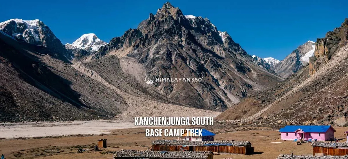
Kanchenjunga South Base Camp Trek

Destination

Nepal, Kanchenjunga Region

Max. Altitude

4,740 m/15,551 ft

Difficulty

Challenging

Best Season

Mar, Apr, May, Sept, Oct, Nov

Transportation

Bus, Jeep, Flight

Start / End

Kathmandu / Kathmandu

Accommodation

Tea houe, and 3 Star hotel

Meals

B.L.DBreakfast Lunch Dinner

Trek Distance

103 km/64 mile

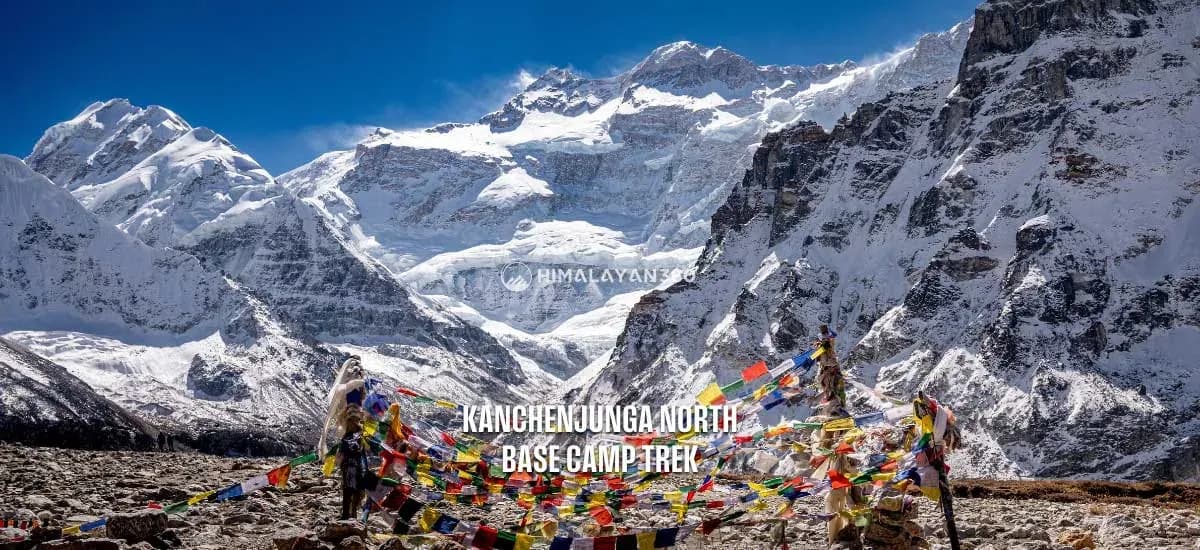
The Kanchenjunga South Base Camp Trek is a raw, off-the-beaten-path adventure in the Kanchenjunga region of Nepal. The trek takes you closer to the third highest mountain in the world, Mount Kanchenjunga (8,586m / 28,169 ft), located in Eastern Nepal. During this wonderful trek, you will walk through the Kanchenjunga Conservation Area, which is home to forests, waterfalls, remote mountain villages, and incredible biodiversity.

While most treks to Kanchenjunga take over three weeks, we’ve carefully crafted this 14-day itinerary to give you the full experience in just two weeks. The trail gradually climbs through lush valleys, crop fields, and peaceful villages to the base camp at Ramche at over 4500m. Along the way, you’ll witness towering peaks such as Mt. Makalu (8,481m), Mt. Jannu (7,710m), Ramtang Peak (6,601m), and of course, Kanchenjunga itself.

Per Person From

$1,899

14 Days

Experts for help

Ask our travel experts about customising this trip.
Build Your Custom Trip

Per Person From$1,89914 Days

Major Highlights of Kanchenjunga South Base Camp Trek

  • Get the stunning views of mountains like Kanchenjunga, Makalu, Ramtang, Jannu, and others.
  • Experience the rich and unique culture of remote Nepali mountain communities.
  • Explore one of the most challenging trekking destinations of Nepal in the Kanchenjunga South Base Camp Trek.
  • Get the chance to learn about the rich and unique cultures and traditions of Hindus and Buddhists.
  • Discover glaciers, mountains, lakes, waterfalls, forests, and charming villages.
  • Stroll through Kanchenjunga Conservation Area, and get the chance to see rare animals like the snow leopard.
  • Stay in local tea houses to enjoy the local lifestyle and food.
  • Scenic views of Mount Rathong and Mount Kabru towering over a glacier moraine along the Nepal and Sikkim border.

Kanchenjunga South Base Camp Trek at a Glance

Distance, walking time and high point for each day
DayItineraryDistance / TimeAltitude
01Domestic flight from Kathmandu to Bhadrapur and to Ilam by Local busroad transfer82 km4 hrs1,627 mIlam
02Ilam to Taplejung by Local busroad transfer152 km6 hrs1,820 mTaplejung
03Taplejung to Lali Kharka9 km6 hrs2,266 mLali Kharka
04Lali Kharka to Khesewa10.5 km7 hrs2,266 mLali Kharka
05Khesewa to Mamangkhe11 km7 hrs2,125 mKhesewa
06Trek form Mamangkhe to Yamphudin10 km7 hrs1,786 mMamangkhe
07Yamphudin to Tortong9.5 km7 hrs2,980 mTortong
08Tortong to Cheram10 km7 hrs3,868 mCheram
09Cheram to Ramche6.6 km4 hrs4,610 mRamche
10Day hike up to Kanchenjunga South base camp7.4 km5 hrs5,140 mOktang
11Trek back from Ramche to Tortong16.6 km7 hrs4,610 mRamche
12Trek back from Tortong to Ranipul12.5 km7 hrs2,980 mTortong
13Drive Back from Ranipul to Phidim bazaar by local jeep
14Drive back from Phidim to Bhadrapur and to kathmanduroad transfer124 km5 hrs
On foot, across 11 trekking days103.1 km64 hrs5,140 m

Reviews from our Guests

From travellers who walked this exact itinerary.

★★★★★

The villages on the southern route are further apart than I expected and some days were seven or eight hours. Yamphudin is the last real settlement before things get remote. Once past it the trail climbs steadily and the scenery opens up. If you are choosing between north and south, the south is quieter but the north gives you the bigger single view.

RT
Rebecca TanApril 2026
★★★★★

Flight to Bhadrapur, bus to Ilam through tea plantations, then a jeep to the trailhead on a road I would rather not describe. It takes days before you even start walking. But that is the point. By the time you are on the trail you are properly far from everything. Very few teahouses, very few people, and mountains that almost nobody photographs.

SL
Sandra LindgrenApril 2026
★★★★★

The southern approach through Yamphudin and Tortong is greener and feels wilder than I expected, with proper forest before you break out above the treeline. Ramche is a beautiful spot and the walk up towards Oktang with Kanchenjunga south face ahead is superb. Nabaraj managed the food carefully on this section because supplies get thin, and we never went short.

HM
Hugo MarchandNovember 2025 · Guided by Nabaraj Simkhada
★★★★★

This is not a trek for someone who wants comfort. Lodges are basic and sometimes full, the days are long, and the weather changes fast. What you get in return is the third highest mountain in the world with hardly anyone else looking at it. The section along the river from Sekathum was slippery and we crossed several suspension bridges that made me concentrate.

IC
Ishaan ChatterjeeNovember 2025
★★★★★

Ghunsa is a proper Tibetan style village and the rest day there is essential, both for acclimatisation and because it is a lovely place to sit still for a day. Nabaraj used the time to walk us up the hillside slowly rather than letting anyone lounge around, which I think is why nobody in our group got sick later. This is a long remote trek and having someone who has done it many times matters.

BD
Bram de VriesOctober 2025 · Guided by Nabaraj Simkhada

Kanchenjunga South Base Camp Trek Day By Day Itinerary

Download this itinerary

Day 01: Domestic flight from Kathmandu to Bhadrapur and Drive to Ilam by Local bus

Itinerary Details
Itinerary FactDetails
Travel Duration:4 Hours
Travel Distance:82 km/50 miles
Flight Hours:45 min
Highest Altitude:1,627 m/5,328 ft Ilam

Today is the first day of the Kanchenjunga Base Camp Trek, which begins with breakfast in Kathmandu. After breakfast, you will go to the TIA airport to board a 45-minute flight from Kathmandu to Bhadrapur. This flight gives you an aerial view of the landscape below.

Once you arrive in Bhadrapur, you will take a local bus to Illam. This journey usually takes three to four hours, depending on the road conditions. Once in Ilam, you will check into the hotel. The rest of the day, you can explore some famous tea areas. Overnight stay in a hotel in Ilam.

Itinerary Details
Itinerary FactDetails
Meals:Lunch and Dinner
Accommodation:Guest house or Tea house

Day 02: Drive from Ilam to Taplejung by Local bus

Itinerary Details
Itinerary FactDetails
Travel Duration:6 Hours
Travel Distance:152 km/94 miles
Highest Altitude:1,820 m/5,971 ft Taplejung

On the second day, after breakfast, you will leave Illam and head to Taplejung in a local bus. As you leave the tea gardens of Ilam behind, you’ll pass through green farmland and hillside villages. You may even get your first glimpse of the Kanchenjunga range from certain points along the Ilam Taplejung route.

The road will get steeper and more winding after you pass the small settlement of Phidim. You will enter the Kanchenjunga Conservation Area when you reach Taplejung. Overnight at Taplejung.

Itinerary Details
Itinerary FactDetails
Meals:Breakfast, Lunch and Dinner
Accommodation:Tea House or Lodge

Day 03: Trek from Taplejung to Lali Kharka

Itinerary Details
Itinerary FactDetails
Trek Distance:9 km /5.5 miles
Ascent:489 m/1,604 ft
Descend:43 m/141 ft
Trek Duration:6 Hours
Highest Altitude:2,266 m/7,434 ft Lali Kharka

From today, the South Base Camp trek begins officially as you will finally start hiking. After breakfast in Taplejung, you’ll begin your trek toward Lali Kharka. The trail takes you through old villages, green forests, and rocky paths. Along the way, you’ll pass through farmland and small settlements where you can see the daily life of the local Limbu people.

You might get a chance to learn about their traditional Kirati culture. As you climb higher, the forest starts to change, and the views become wider, with hills and valleys all around. Lali Kharka is a quiet place with just a few teahouses, where you’ll rest for the night.

Itinerary Details
Itinerary FactDetails
Meals:Breakfast, Lunch and Dinner
Accommodation:Tea House or Lodge

Day 04: Trek from Lali Kharka to Khesewa

Itinerary Details
Itinerary FactDetails
Trek Distance:10.5 km /6.5 miles
Ascent:314 m/1,030 ft
Descend:449 m/1,473 ft
Trek Duration:7 Hours
Highest Altitude:2,266 m/7,434 ft Lali Kharka

The fourth day of the South Base Camp of Kanchenjunga trek itinerary takes you to Khesewa. Today’s trek begins with a climb to a ridge, followed by a steep descent into Simbu. After reaching Simbu, the trail steeply ascends to Kunjari, a village surrounded by bamboo and banana trees. Then, the path descends a steep road and crosses a suspension bridge over the Phawa Khola river.

You will have a long walk uphill to the Gurung settlement where you can find nice tea houses for lodging, including Kande Bhanjyang, Sinchebu, and Sinchewa Bhanjyang. The rest of the day will be spent in the Kabeli Valley, where you will first see the Kangchenjunga landscape. Later, the route goes through a forest and leads to Khesewa, a prosperous town that grows millet, maize, and rice.

Itinerary Details
Itinerary FactDetails
Meals:Breakfast, Lunch and Dinner
Accommodation:Tea House or Lodge

Day 05: Trek from Khesewa to Mamangkhe

Itinerary Details
Itinerary FactDetails
Trek Distance:11 km /6.8 miles
Ascent:75 m/246 ft
Descend:414 m/1,358 ft
Trek Duration:7 Hours
Highest Altitude:2,125 m/6,972 ft Khesewa

The trek from Khesewa to Mamangkhe (1786m) continues along the Kanchenjunga South Base Camp trail, typically taking 5-6 hours. The first section of the trek is a gradual descent, passing through cultivated lands and the Kabeli Khola. Along the way, you will pass through the village of Phale, a Tibetan refugee settlement with traditional houses and small monasteries.

You will reach the village of Anpan before finally climbing to Mamangkhe, a significant cultural hub for the Limbu, Rai, and Kirat communities. Once in Mamangkhe, you can visit a local cultural museum that gives insight into the customs and daily life of the people in this region. Overnight in Mamangkhe.

Itinerary Details
Itinerary FactDetails
Meals:Breakfast, Lunch and Dinner
Accommodation:Tea House or Tent

Day 06: Trek form Mamangkhe to Yamphudin

Itinerary Details
Itinerary FactDetails
Trek Distance:10 km /6.2 miles
Ascent:0 m/0 ft
Descend:94 m/302 ft
Trek Duration:7 Hours
Highest Altitude:1,786 m/5,860 ft Mamangkhe

The sixth day of the Kanchenjunga South Base Camp trek itinerary begins with breakfast in Mamangkhe teahouses. We start our trek along the Kabeli Khola, surrounded by dense rhododendron forests, rivers, and waterfalls. The route crosses charming wooden bridges and leads us past hillside farms where locals cultivate maize and millet.

Yamphudin, our destination, is the last significant settlement before entering the remote high-altitude region. Here, we will experience a blend of Limbu and Tibetan cultures while enjoying spectacular sunset views over the hills. Overnight stay at Yamphudin tea house.

Itinerary Details
Itinerary FactDetails
Meals:Breakfast, Lunch and Dinner
Accommodation:Tea House or Tent

Day 07: Trek from Yamphudin to Tortong

Itinerary Details
Itinerary FactDetails
Trek Distance:9.5 km /5.9 miles
Ascent:1,723 m/5,653 ft
Descend:435 m/1,427 ft
Trek Duration:7 Hours
Highest Altitude:2,980 m/9,777 ft Tortong

The Kanchenjunga South Base Camp Trek is getting tougher by the day as you gain a lot of altitude. Leaving Yamphudin, the trail climbs steadily through beautiful rhododendron forests and stone steps leading to Lasiya (Lamite) Bhanjyang. From Lasiya, the path leads down to a grassy pass. You can see Mt. Jannu, also known as Kumbakarna, to the northeast, above a large landslip.

After a short climb and a zigzag trail through thick forest, we’ll reach the Simbuwa Khola (river). From the river, it’s a final steady ascent to reach the peaceful village of Tortong, where you’ll spend the night surrounded by nature.

Itinerary Details
Itinerary FactDetails
Meals:Breakfast, Lunch and Dinner
Accommodation:Tea House or Lodge

Day 08: Trek from Tortong to Cheram

Itinerary Details
Itinerary FactDetails
Trek Distance:10 km / 6.2 miles
Ascent:888 m/2,913 ft
Trek Duration:7 Hours
Highest Altitude:3,868 m/12,690 ft Cheram

Following the Simbuwa Khola, we will hike through dense rhododendron forests, where vibrant pink and red blossoms add color to the landscape. We will pass through Yalung Glacier viewpoints to catch our first close-up views of Kanchenjunga’s massive peaks.

As we approach Cheram, the landscape will become more rugged, with towering cliffs and vast open meadows. This small settlement will serve as our base before we head into even higher elevations. Today, there’s a big gain in altitude, so it’s important to walk slowly and drink plenty of water.

Itinerary Details
Itinerary FactDetails
Meals:Breakfast, Lunch and Dinner
Accommodation:Tea House or Tent

Day 09: Trek from Cheram to Ramche

Itinerary Details
Itinerary FactDetails
Trek Distance:6.6 km / 4.1 miles
Ascent:774 m/2,539 ft
Descend:32 m/105 ft
Trek Duration:3-4 Hours
Highest Altitude:4,610 m/15,125 ft Ramche

The trek from Cheram to Ramche on Day 9 is a shorter 3-4 hours journey and also marks an increase in altitude as you head closer to the Kanchenjunga South Base Camp. The trail generally follows the valley, offering increasingly impressive close-up views of snow-dusted Himalayan peaks and glacial moraines, including the majestic Kanchenjunga massif.

Before reaching Ramche, you’ll pass through Lapsang village, experiencing the rugged alpine scenery as you gain elevation. Ramche is not a typical village, but rather a resting point for trekkers heading toward the Kanchenjunga South Base Camp. From here, it takes only about an hour of hiking to reach the base camp of the world’s third-highest peak, Mount Kanchenjunga.

Itinerary Details
Itinerary FactDetails
Meals:Breakfast, Lunch and Dinner
Accommodation:Tea House or Tent

Day 10: Day hike up to Kanchenjunga South base camp

Itinerary Details
Itinerary FactDetails
Trek Distance:7.4 km /4.5 miles
Ascent:130 m/427 ft
Descend:130 m/427 ft
Trek Duration:5 Hours
Highest Altitude:5,140 m/16,864 ft Oktang

From Ramche, we will hike to the South Base Camp to see amazing views of the south side of the mountain Kanchenjunga from the Oktang viewpoint, situated at 4,730 meters. The trekking trail is not too difficult and follows the glacier as it curves north. After about an hour, we’ll reach a viewpoint where you can finally see the full south as well as the west face of Kanchenjunga, which was hidden before.

If you want to explore more, you can walk for another hour on a small path along the edge of the Yalung Glacier. There, you’ll find a chorten (a small Buddhist monument) with clear views of Kanchenjunga (8,586m), Yalung Kang (8,505m), and Khambachen Peak (7,903m). After enjoying the views, you’ll return to Ramche to spend the night.

Itinerary Details
Itinerary FactDetails
Meals:Breakfast, Lunch and Dinner
Accommodation:Tea House or Tent

Day 11: Trek back from Ramche to Tortong

Itinerary Details
Itinerary FactDetails
Trek Distance:16.6 km /10.3 miles
Ascent:32 m/105 ft
Descend:1,662 m/5,453 ft
Trek Duration:7 Hours
Highest Altitude:4,610 m/15,125 ft Ramche

After exploring the Southern Base Camp of Mt. Kanchenjunga, today we start our return journey. The South Kanchenjunga base camp trek route retraces the same route back to Tortong. Enjoy the stunning views of the snow-covered Himalayas along the way.

The first part of the hike is steep and can be slippery in places, so you’ll need to walk carefully, especially near the landslide-prone sections. After this, the trail becomes gentler as it goes through beautiful rhododendron and pine forests. You’ll walk along the Simbuwa Khola, enjoying views of snowy peaks before crossing a small bridge to reach Tortong. Overnight stay at a tea house or tent in Tortong.

Itinerary Details
Itinerary FactDetails
Meals:Breakfast, Lunch and Dinner
Accommodation:Tea House or Lodge

Day 12: Trek back from Tortong to Ranipul

Itinerary Details
Itinerary FactDetails
Trek Distance:12.5 km /7.7 miles
Ascent:35 m/115 ft
Descend:1,465 m/4,806 ft
Trek Duration:7 Hours
Highest Altitude:2,980 m/9,777 ft Tortong

On the 12th day of our trek, we continue descending and retracing our steps. The path continues downhill, weaving through deep forests and charming villages. We will pass through Yamphudin once again, where we can enjoy a final glimpse of the region’s cultural richness. The Kabeli Khola’s gentle flow accompanies us as we approach Ranipul, marking the end of our trekking journey. Here, we will rest before beginning our road journey back.

Itinerary Details
Itinerary FactDetails
Meals:Breakfast, Lunch and Dinner
Accommodation:Tea House or Lodge

Day 13: Drive Back from Ranipul to Phidim bazaar by local jeep

On Day 13, we will take a local jeep from Ranipul to Phidim bazaar. This is a common way to travel in this hilly area of Nepal. The drive will be bumpy but scenic, with winding roads and views of small villages and the eastern hills. The jeep ride will take a few hours, depending on the road conditions and any stops you make along the way. Phidim Bazaar is the main trading hub in the area.

Itinerary Details
Itinerary FactDetails
Meals:Breakfast, Lunch and Dinner
Accommodation:Tea House or Lodge

Day 14: Drive back from Phidim to Bhadrapur and fly back to kathmandu

Itinerary Details
Itinerary FactDetails
Travel Duration:5 Hours
Travel Distance:124 km /77 miles
Flight Hours:45min
  • Attraction of the day: Thamel tourist market

Today is the last day of our Kanchenjunga South Base Camp Trek. You will drive on a scenic road from Phidim to Bhadrapur and see the eastern hills of Nepal. The path passes through the terraced rice fields, villages, and jungles before hitting the flat plains of Jhapa. Once in Bhadrapur, you will fly back to Kathmandu, concluding our amazing 14-day trekking in the Kanchenjunga region. In the evening, enjoy a farewell dinner to celebrate the incredible journey you’ve just completed. We hope you enjoyed this amazing adventure.

Itinerary Details
Itinerary FactDetails
Meals:Breakfast Dinner
Accommodation:3 Star Hotel

Kanchenjunga South Base Camp Trek Included/ Excluded

Cost Includes

Cost Excludes

Transfer

  • Airport transfer for a domestic flight
  • Kathmandu to Bhadrapur to Kathmandu flight
  • Bhadrapur to Ilam to Taplejung by public transport
  • Ranipul to Bhadrapur by public transport
  • International flight
  • Private transfer during the trek
  • Extra transfer which is not mentioned in itinerary

Accommodation & Meals

  • 1 Night Kathmandu in a 3-star hotel (sharing basis)
  • 1 Night in Bhadrapur in Normal Guest house (sharing basis)
  • 1 Night in Ilam in Normal Guest House (Sharing Basis)
  • 12 nights in the mountain tea house or camping (on a shared basis)
  • Food: 15 Breakfast, 14 Lunch, 15 Dinner
  • Extra night accommodation in Kathmandu due to early arrival or late departure, or early return from the trek
  • Extra nights in Ilam
  • Extra night during Trekking

Support

  • Government-licensed English-speaking local trek leader
  • Porter to carry bags (2:1porter)

Permit & Insurance

  • Restricted Area Permit (RAP)
  • Kanchenjunga Conservation Area Project (KCAP)
  • Local Gov.Permit Fees
  • Nepal visa fees
  • Travel insurance that covers emergency high-altitude rescue and evacuation (compulsory)

Others

  • Gov. and local tax and agency service charges
  • Free luggage storage services in Kathmandu
  • Appreciation Certificate after the successful trek
  • Free consulting services before & after trek book
  • Farewell dinner at the end of the trek
  • Staff insurance, salary, equipment, food & clothing.
  • Duffle bag during trek (should return after trek)
  • MEDICAL KIT: Comprehensive Medical kit.
  • Personal clothing and gear and Personal expenses: shopping, snacks, boild water, drinks, hot shower, alcohol, Wi-Fi, calls, battery charging, extra porters, etc.
  • Tips for staff (it is expected)
  • All other costs and expenses not listed in “including”
  • Additional cost: Additional costs incurred due to causes beyond our control, for example weather conditions, landslides, itinerary modifications, illness, government policies change, strikes, etc.

Route & Elevation

01k2k3k4k5kD1D2D3D4D5D6D7D8D9D10D11D12Oktang 5,140 m
Highest point reached on each day, plotted against distance walked. Metres on the left, day number along the bottom.

FAQs for Kanchenjunga South Base Camp Trek

Kanchenjunga South Base Camp Trek Information

Difficulty

Challenging

Best Season

Mar, Apr, May, Sept, Oct, Nov

Weighing It Against the Alternatives

If you are still deciding, this is how Kanchenjunga South Base Camp Trek sits against the trips people most often weigh it against — on days, distance, difficulty and cost.

This trip compared with the alternatives
TripDays / DistanceDifficultyFrom
Kanchenjunga South Base Camp Trekthis trip14 days103 kmChallenging$1,899
14 Days Wildlife and Birdwatching Photography Tour14 daysEasy$1,999
Everest Base Camp Trek14 days114.48 kmStrenuous$1,260
Manaslu Circuit Trek14 days143.7 kmStrenuous$920
15 days Tsum Valley Trek15 days147.2 kmMedium$965

More trips like Kanchenjunga South Base Camp Trek

$1,899 per person

Himalayan360Everything there is to do in the Himalayas

  • AdventureTrek the Himalayas, fly over them at sunrise, land at base camp, drift across the lake at Pokhara
  • CulturalLearn Kathmandu’s temples, eat your way through the city, sit at a festival in Bhutan
  • SpiritualRoll out a yoga mat on the trail, walk to Muktinath, cross Tibet to Kailash

Every path, Himalayan360 has you covered.

Trip Planner