
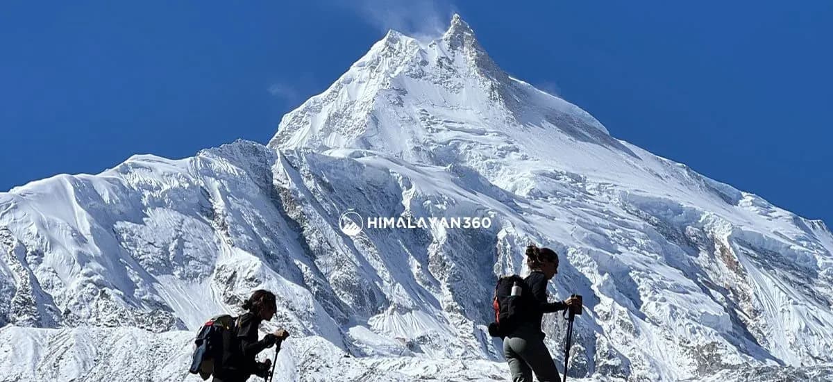
The Manaslu Conservation Area is one of the protected areas of Nepal, in the northern-central Himalayas of Nepal. The conservation area is located in Gorkha District and was declared by the Government of Nepal in 1998 to conserve wildlife, forests, and traditional mountain culture. It covers about 1,663 sq km and protects the landscape around Mount Manaslu (8,163M), the world’s eighth-highest mountain. The area lies in Gorkha District and extends to the Nepal–Tibet border.
The conservation area spans the whole Manaslu massif and every valley that drains it, so the Manaslu area is protected from the river gorges to the summit ice. This protected area is home to two famous treks: the Manaslu Circuit Trek and the Tsum Valley Trek. Both treks are located entirely inside the Manaslu Conservation Area and start from the lower hills of Gorkha before to the alpine valleys near Tibet. The region supports over 2,000 plant species and rare animals like snow leopards and red pandas. Villages here reflect Tibetan Buddhist culture, with festivals like Lhosar and Buddha Jayanti bringing people together for rituals, traditional dances, and community celebrations.
Manaslu Conservation Area at a Glance
The Manaslu Conservation Area Project (MCAP) is the management body that runs it, set up by the National Trust for Nature Conservation in the late 1990s. Manaslu Conservation Area is home to Nepal's eighth 8,000M peak and to the villages that farm beneath it.
| Detail | Figure |
|---|---|
| Established | December 1998 |
| Area | 1,663 sq km |
| District | Gorkha, northern-central Nepal |
| Elevation range | 600M to 8,163M |
| Managed by | National Trust for Nature Conservation (NTNC) |
| Highest point | Mount Manaslu, 8,163M |
| Main treks inside it | Manaslu Circuit Trek, Tsum Valley Trek |
| Plant species | More than 2,000 |
Geography of the Manaslu Conservation Area
The Manaslu Conservation Area lies within the Mansiri Himal range. It borders the Tibetan Plateau to the north, the Annapurna Conservation Area to the west, and the Ganesh Himal to the east. The landscape rises from river valleys to high snow peaks. Mount Manaslu stands as the highest peak in the region. Other major peaks include Himalchuli (7,893M), Ngadi Chuli (7,871M), and Shringi Himal (7,187M).
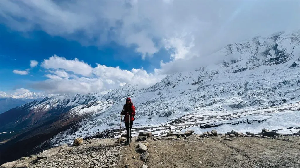
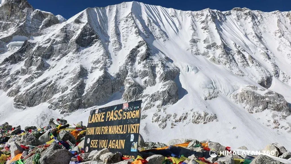
One of the most important land features is Larkya La Pass, which reaches about 5,106M. This pass connects remote valleys and forms the highest point of the Manaslu Circuit Trek. Water reforms much of the geography of this conservation area. The Budhi Gandaki River flows through the center of the region and stretches for about 150 km. This river valley supports villages and trails used by trekkers.
Glaciers like the Larkya Glacier and the Pungyen Glacier cover the higher slopes. The land itself formed around 50 million years ago after the Indian plate pushed into the Eurasian plate. The ground still rises slowly today and contains granite, dolomite, quartzite, and slate.
Climate Patterns in the Manaslu Region
The Manaslu region experiences four clear seasons that affect trekking conditions and daily life. Spring, from March to May, and autumn, from September to November, are the best seasons for trekking experience here, while summer and winter are cold with snowfall at higher elevations. Here’s a table for microclimate based on altitude.
| Elevation Zone | Climate Type | Typical Daytime Temperature | Nighttime Temperature |
|---|---|---|---|
| Lower (<2,000m) | Subtropical | 15°C – 30°C | 8°C – 15°C |
| Mid (2,000–3,500m) | Temperate | 10°C – 20°C | 0°C – 10°C |
| High (>3,500m) | Alpine/Arctic | -5°C – 10°C | -10°C – -25°C |
Flora and Fauna: Forest Types and Vegetation Zones
The Manaslu Conservation Area shows a great change in plant life with rising altitude. The region supports more than 2,000 species of flowering plants and holds between 11 and 16 types of forest. This wide range exists because the land rises from river valleys to high snow fields.
The lowest valleys from about 600M to 2,000M hold subtropical forests. Sal trees grow widely here, along with Schima and Castanopsis. Bamboo groves and wild banana plants are common in moist areas. From 2,000M to 3,000m, temperate forests appear and include oak, maple, and blue pine. Rhododendron trees bloom in spring and color the hillsides red.
Between 3,000m and 4,000m, subalpine forests cover the land with juniper, birch, and fir. Snow covers this zone for nearly half the year. Above 4,000m, alpine meadows replace forests, and permanent snow begins above 5,000 m, where only lichens and hardy plants survive near the glaciers.
Rivers, Glaciers, and Natural Features
Most rivers in Manaslu Conservation Area begin from glaciers and seasonal mountain snow. The Budhi Gandaki River is the main waterway and flows from the Tibetan border. The Manaslu Circuit Trek follows this river for many days. In the lower sections between Jagat and Deng, the river creates gorges with high cliffs on both sides.
Many smaller streams flow down from high peaks and cross the walking trails. These streams carry cold water from melting ice and snow near villages like Shyala and Samagaun. West of Larkya La Pass, the Dudh Khola flows through the Bimthang valley. This river later joins the Marsyangdi River and connects the Manaslu region with the Annapurna area.
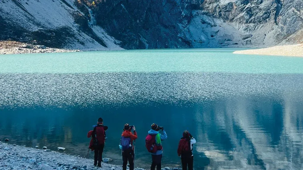
Glaciers and lakes add to the natural character of the region. The Manaslu Glacier and the Pungyen Glacier lie close to Pungyen Gompa, a working monastery under the south face of the Manaslu peak, and to Birendra Lake (3,691m) and holds turquoise water formed by meltwater from the Manaslu Glacier. This lake is a popular acclimatization walk for trekkers. Kal Tal, also known as Black Lake, is located above the village of Prok and remains less visited. These natural features define the Manaslu Conservation Area.
Wildlife of the Manaslu Region and Its Biodiversity
The Manaslu Conservation Area supports rich wildlife due to its wide range of elevations and habitats. The official figures published for the area record 33 species of mammals and 110 species of birds, alongside three species of reptiles; wider surveys since have pushed the counts higher. Cold climate and limited human impact help protect animals that are rarely seen in other trekking regions of Nepal, and wildlife conservation here is what keeps snow leopards and red pandas in the valley at all.
| Biological Group | Estimated Count | Notable Species |
|---|---|---|
| Mammals | 33–39 species | Snow Leopard, Red Panda, Himalayan Black Bear, Musk Deer, Himalayan Tahr, Blue Sheep, Grey Wolf, Himalayan Goral, Assam Macaque |
| Birds | 110–201 species | Himalayan Monal (Danphe), Golden Eagle, Lammergeier, Snow Partridge, Tibetan Snowcock, Blood Pheasant, Satyr Tragopan, Himalayan Griffon |
| Herpetofauna | 16+ species | 9 reptiles and 7 amphibians (e.g., Himalayan Toad, Brook Frog, Oriental Rat Snake, Garden Lizard) |
| Insects | 11+ species | High altitude butterflies, Apollo Butterfly, Swallowtail Butterfly |
Local Culture and Cultural Heritage
Three communities live inside the boundary and they do not share one background. The lower valleys below Jagat are Gurung and Tamang, farming terraces of millet and maize. The upper Nubri valley around Lho, Samagaun and Samdo is ethnically Tibetan, and Tsum Valley to the east is its own case again, with a Buddhist tradition old enough to predate the Nepali state.
The cultural heritage that survives here is the reason the area was protected as much as the wildlife was. Monasteries such as Pungyen Gompa and Ribung Gompa at Lho still function, mani walls line the trail into every village, and the Tibetan culture of the upper valley shows most clearly at Lhosar, when the New Year is marked with masked dances. Trekkers walk through all of it, which is why the conservation rules ask visitors to treat the villages as homes rather than exhibits.
Trekking in Manaslu: Routes Inside the Conservation Area
Trekking in Manaslu means walking inside this conservation area from the second day to the last. Three trekking routes use it, and they share the same trailhead at Machha Khola.
- Manaslu Circuit Trek. The full loop up the Budhi Gandaki and over Larkya La Pass into the Annapurna side. It is the main route and the reason most trekkers come.
- Tsum Valley Trek. A branch north-east from Lokpa into a side valley of monasteries and Tibetan culture, walked on its own or added to the circuit.
- Manaslu Base Camp and Birendra Lake. Day walks from Samagaun, used as acclimatisation rather than as treks in their own right.
All three trekking trails are teahouse routes rather than camping expeditions, and all three need the same three permits. A Manaslu adventure here is quieter than the Everest Base Camp trek by a wide margin, because the permit system caps how many people are on the trail at once.
Trekking Rules Inside the Conservation Area
- A licensed guide is compulsory: Solo trekking is not allowed. Every trekker must travel with a government-licensed guide from a Nepal Tourism Board-registered agency.
- Group size: Since March 2026 the Restricted Area Permit can be issued to a single trekker, so the old two-person minimum no longer applies. One licensed guide may lead a maximum of seven trekkers.
- Permit and passport checks: Original permits and passports must be shown at official checkpoints like Jagat, Deng, Samagaun, and Samdo. Digital copies are not accepted.
- Follow the approved trekking route: Trekkers must follow the approved itinerary. Entry into restricted border zones near Tibet is strictly prohibited.
- Environmental responsibility: Single-use plastic is discouraged throughout the conservation area.
- Photography and drone rules: Normal photography is allowed. Special permission is required for professional filming and drone use.
Permit System for the Manaslu Conservation Area
Three permits are needed to trek the Manaslu Conservation Area: the Restricted Area Permit (RAP) for the Jagat to Dharapani section, the Manaslu Conservation Area Permit (MCAP), and the Annapurna Conservation Area Permit (ACAP) for the exit past Dharapani. A rural municipality fee is collected locally on some sections and is not part of the three. The table below explains each one.
| Permit Type | Validity | Approx. Cost (Foreigners) |
|---|---|---|
| Restricted Area Permit (RAP) | Duration-specific | USD 100 (Sep–Nov) or USD 75 (Dec–Aug) for the first 7 days |
| Manaslu Conservation (MCAP) | Single Entry | NPR 3,000 (about USD 22) |
| Annapurna Conservation (ACAP) | Single Entry | NPR 3,000 (about USD 22) – Required for exit via Dharapani |
| Rural municipality fee (collected locally) | Single Entry | NPR 2,000 (about USD 15) |
Importance of the Conservation Area for the Manaslu Circuit Trek
The Manaslu Circuit Trek depends on the Manaslu Conservation Area for its natural beauty and long-term sustainability. Here’s why Manaslu Conservation Area is important for this trek.
- The conservation area protects the raw Himalayan scenery
- The conservation area status protects habitats for endangered species like the snow leopard and red panda
- It protects 1,663 sq km of different forests (oak, rhododendron, blue pine) and important water bodies like Birendra Lake and the Budhi Gandaki River
- MCA conservation rules support the local culture and traditional lifestyles of the Nupri and Tsum Valley communities, and any Manaslu trek you book pays into that system
- Monasteries, mani walls, and chortens are preserved by local committees with the support of conservation program.
- Permit rules limit crowd numbers and reduce environmental pressure. This maintains trail quality and long-term trekking safety.
Conservation Efforts, Tourism and Local Communities
Area management sits with the National Trust for Nature Conservation rather than the Department of National Parks and Wildlife Conservation, which is why the model here is community-led. Conservation efforts are funded largely by permit income, and they run through local committees that also handle trail repair, drinking water and school support. Sustainable tourism is the stated goal and the practical one: environmental conservation in a valley with no road only works if the local communities living in it are better off for the rules.
How to Reach the Manaslu Conservation Area
There is no airstrip and no road inside the conservation area, so every visit starts with a drive. The trailhead at Machha Khola is about 160KM northwest of Kathmandu and takes 8 to 10 hours by road, paved as far as Arughat and rough after that. Public buses leave Gongabu Bus Park early in the morning; a private 4WD jeep is the faster and more comfortable option and carries a whole group with its guide and porters.
You enter the conservation area on foot between Jagat and Deng on the second walking day, and you leave it on the far side of Larkya La at Dharapani, where the Annapurna Conservation Area begins. Everything in between is walked. Beyond Samagaon there is no vehicle access at all, which is why evacuation from the upper valley is by helicopter only. The full walking route, its distances and the seasons that suit it are covered in the Manaslu Circuit Trek difficulty, distance and best season guide.
Conclusion
The Manaslu Conservation Area stands as one of the most important protected mountain regions of Nepal. It preserves landscapes formed by high peaks, deep river valleys, glaciers, and alpine lakes. Rich forests change with elevation and support rare wildlife. Strict trekking rules and permit systems protect ecosystems while providing safe and controlled access for trekkers.
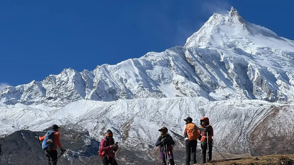
For the Manaslu Circuit Trek, this conservation area is essential. It protects the natural scenery, cultural heritage, and traditional village life that make the trek special. From biodiversity conservation to cultural preservation, the region shows how trekking and protection can work together.


14 Days
Manaslu Circuit Trek
$920
5.0(7 reviews)
The Manaslu Circuit Trek is a stunning 13-18 day teahouse trek in Nepal, circling the world’s 8th highest mountain (Manaslu 8,163m), and covers about 144KM (89 Miles). The trek journey starts at Machha Khola and slowly climbs through farmlands and small villages. As you move higher, you reach mountain valleys like Samagaon and Samdo. The biggest highlight is crossing the Larkya La Pass (5,160M), where you can see amazing views of Manaslu, Himalchuli, and Ngadi Chuli. The trek also offers a local culture experience. Villages such as Samagaon, Namrung, Lho, and Deng show strong Tibetan traditions. You will see monasteries, prayer flags, and mani walls along the way. Depending on the season, you may also witness festivals like Lhosar (Tibetan New Year) or Saga Dawa, which celebrates Buddha’s life. In these villages, people farm millet, herd yaks, and live in ways passed down for centuries. This gives trekkers a close look at a culture that is still very traditional. The Manaslu Circuit trek trail also takes you through different natural landscapes. In the lower region at Jagat and Soti Khola, you will walk through green forests alive with rhododendron, magnolia, and bamboo. As you go higher past Philim, Namrung, and Samdo, the forest changes into oak, maple, and conifers, with waterfalls along the way. Near Samagaon and Larkya La, the land becomes rocky and snowy, with only small plants like moss and lichens. The changing landscape offer the true trekking experience throughout the Manaslu Circuit trek. Likewise, one special thing about the trek to Manaslu Circuit region is that it is a restricted area. Trekkers need special permits, which help protect the environment and keep the trail less crowded. You will need to compulsorily hire a trekking guide. You can find simple teahouses and lodges in main villages, but the trek still feels wild and quiet compared to other popular routes in Nepal. The best time for Manaslu Circuit trek is during the Spring (March to May) and Autumn (September to October) seasons.
15 Days
15 days Tsum Valley Trek
$965
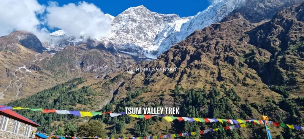
If you are looking for a unique and quiet trekking experience in Nepal away from commercialized trails, Tsum Valley Trek is your ideal option. The Tsum Valley is tucked away in the secluded and restricted part of Gorkha. Its trekking trails are lesser known to the world as it was only opened to outsiders in 2008. It is still not easily accessible and remains untouched by modernization. However, it is also precisely why the region has one of the most well-preserved Tibetan cultural heritages. The trails are also quiet and serene, with thrilling challenges. You will get to trek through raw nature and diverse landscapes, and you will travel close to the Tibetan border. Tsum Valley Trek is an adventurous journey as well as a cultural trip. It is a sacred valley blessed by Guru Rinpoche Padmasambhava himself. During the trek, you will pass several traditional settlements, ancient monasteries, gompas, chortens, mani walls, and colorful prayer flags. The hidden valley is home to locals who follow the ancient Bon Po and Tibetan Buddhism. You will trek within the Manaslu Conservation Area and ascend to Ganesh Himal Base Camp (4,200 meters) during the trek. Similarly, you can witness gorgeous panoramas of Mount Manaslu (8,163 meters), Ganesh Himal (7,140 meters), Himalchuli (7,893 meters), and more. Tsum Valley is truly a hidden gem, and the trek will be a wonderful opportunity to explore raw and rural Nepal.
 Trek
Trek By air
 Pilgrimage
 Festivals
 Wildlife
 Luxury
 Yoga
Yoga Food
Food Heritage