
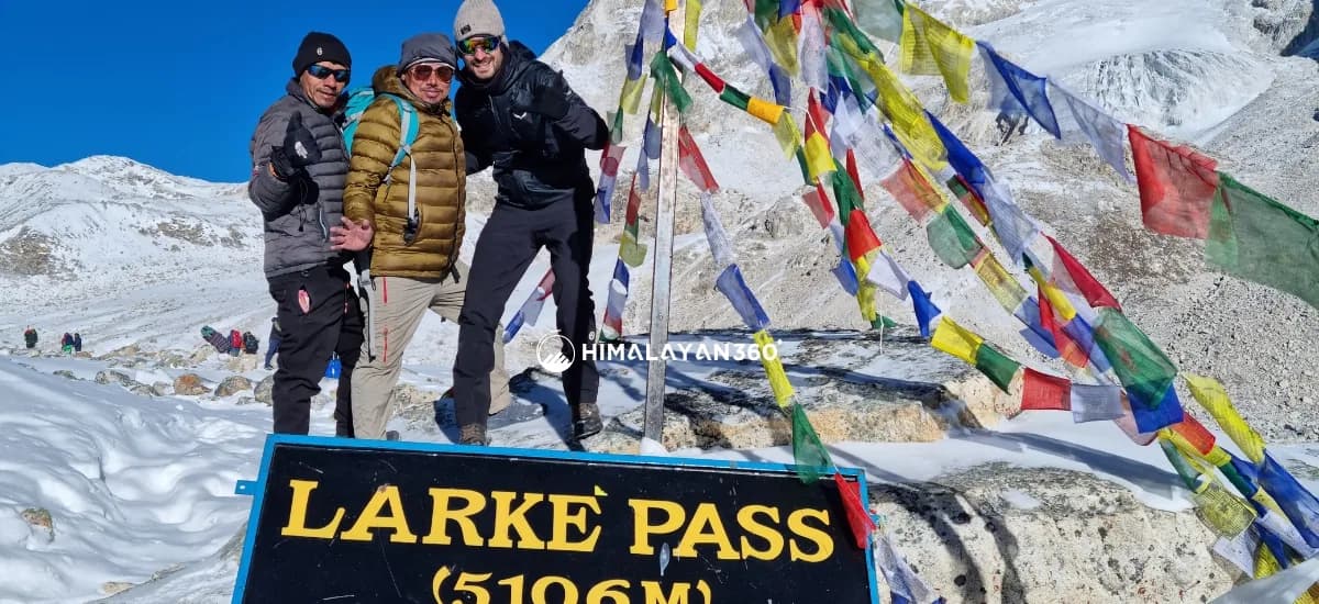
The Manaslu Circuit Trek is strenuous but not technical. It covers 143.7KM (89 miles) of walking from Machha Khola to Dharapani over 13 to 14 days, and its highest point is Larkya La Pass at 5,106M. The best season is autumn, from late September to November, with spring, from March to May, a close second.
What makes it hard is not climbing skill. The trek's difficulty is in the length of the days, the height gained between Namrung and Samdo, and one very long crossing: Dharamsala to Bhimtang over Larkya La is 24.8KM and around 9 hours, the longest and highest day on the route. Counting the road transfers at both ends, the whole trip covers 520 to 550KM, of which 370 to 400KM is driving.
This page answers the three questions trekkers ask before booking the Manaslu Circuit Trek: how hard it is, how far it is, and when to go. Permit paperwork and the full budget breakdown live in the Manaslu Circuit Trek permit and cost guide.
Manaslu Circuit Trek Difficulty Level and Rating
The Manaslu Circuit Trek difficulty rating is strenuous. It sits one grade above the Annapurna Circuit and roughly level with the Everest Base Camp trek on effort, while going well beyond either on remoteness. Circling Mount Manaslu on foot is one of the longer teahouse walks in the Himalayas, and the Manaslu region has less infrastructure behind it than any of the routes it gets compared with. Four difficulty factors decide the grade:
- Trek duration. Eleven long trekking days in a row inside a 13 to 14 day walking schedule, with a single rest day at Samagaun.
- High altitude. Larkya La Pass at 5,106M, and every night above 3,000M from Lho onwards.
- Terrain. Gorge trail, glacial moraine and a long rocky descent rather than a graded path.
- Remoteness. No road, no vehicle and a helicopter as the only way out beyond Samagaon.
None of the four asks for technical skill or mountaineering experience. Together they make this a high-altitude trek that rewards months of preparation rather than a long weekend of enthusiasm. The overall Manaslu Circuit Trek difficulty is best summed up as strenuous but achievable for a fit walker, and each of the four factors is broken down below. Understanding the Manaslu Circuit Trek difficulty level before you book is what stops the pass day coming as a shock.
How Hard is the Manaslu Circuit Trek?
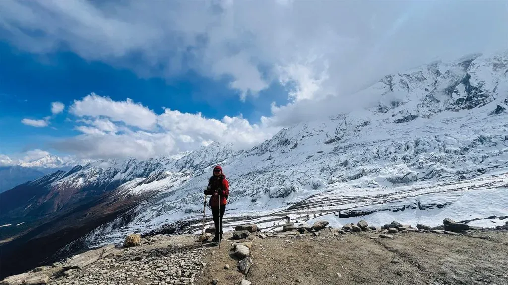
The Manaslu Circuit is graded strenuous. Measured against other Nepal teahouse routes, it asks for more walking hours per day than the Annapurna Circuit and puts you further from help than Everest Base Camp, while the altitude sits in the same band as both. Most days are 6 to 8 hours on the trail, several nights are spent above 3,000M, and the route crosses a pass higher than any point on the standard Everest Base Camp trail.
Nothing on the route needs ropes, crampons or climbing experience in spring and autumn. What the trek demands is physical fitness of the plain endurance kind: the ability to walk a long day, sleep badly at altitude, and get up and do it again. On that measure the Manaslu Circuit Trek is one of the more demanding teahouse routes in Nepal. The Manaslu Circuit Trek is often described as the harder cousin of the Annapurna Circuit, and the difficulty is felt in the legs long before it is felt in the lungs.
Set against the two routes people usually compare it with, the Manaslu Circuit Trek difficulty sits above the Annapurna Base Camp trail and roughly level with the Everest Base Camp trek. Annapurna Base Camp is shorter and tops out lower. The Everest Base Camp trek walks in under Mount Everest on a better-serviced trail, with a medical clinic at Namche and a flight out of Lukla if things go wrong. This route has neither, which is why trekkers who have already walked a base camp trek in the Everest or Annapurna regions still rate this the more challenging trek of the three.
What Makes the Manaslu Circuit Trek Difficult
- Consecutive long days. Eleven walking days in a row, most of them 6 to 8 hours, with no rest day other than Samagaun.
- Sustained altitude. From Lho onwards you sleep above 3,000M every night, and Dharamsala at 4,460M is the last stop before the pass. Acute Mountain Sickness is the most common reason trekkers turn back, and it can escalate into HAPE or HACE.
- The Larkya La crossing. 24.8KM and around 9 hours, gaining 646M to the pass and then dropping steeply into the Marsyangdi side.
- Cold. Temperatures near the pass can drop to -20°C even in trekking season. Without proper cold-weather layers, hypothermia and frostbite are real risks on the crossing.
- Remoteness. Beyond Samagaon, emergency evacuation is only possible by helicopter and can cost USD 3,000 to 5,000. There is no road, and no vehicle can reach you.
- Terrain. The Budhi Gandaki gorge section is a run of suspension bridges, cut-rock stairways and landslide scars, not a graded path. The terrain changes three times on the way round: river gorge, forest and farmland, then moraine and scree above Samdo.
Larkya La Pass, the Hardest Challenge on the Manaslu Circuit
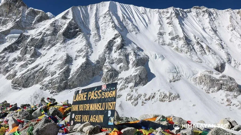
The crossing from Dharamsala (4,460M) to Bhimtang is the single biggest challenge on the Manaslu Circuit and the major difficulty of the whole itinerary: 24.8KM on the trail and about 9 hours of walking at the highest elevation you will reach. Groups normally leave Dharamsala at around 3 AM, because the wind on the pass builds through the afternoon and the descent on the far side is long.
The climb passes frozen tarns and glacial moraine, and the last hour to the 5,106M pass is slow simply because of the thin air. From the top the trail drops steeply through moraine to Bhimtang, and the loose terrain on that descent is where most people feel the day in their knees. Two acclimatisation nights, at Samagaun and Samdo, are what makes this day possible rather than punishing.
Altitude Gain Between Namrung and Dharamsala
The real difficulty of the Manaslu Circuit is not the pass itself but the five days that lead up to it. The section that decides whether the trek goes well runs from Namrung (2,630M) to Dharamsala (4,460M). The sleeping altitude climbs like this:
- Namrung, 2,630M
- Lho and Shyala, 3,500M
- Samagaun, 3,530M, with a full acclimatisation day
- Samdo, 3,875M
- Dharamsala, 4,460M
The working rule above 3,000M is to gain no more than 300 to 500M of sleeping altitude per day. The Samagaun rest day exists to absorb the jump from Namrung, and the optional walk to Manaslu Base Camp (4,800M) or Birendra Lake (3,691M) on that day is a climb-high, sleep-low exercise, not sightseeing.
Fitness and Training for the Manaslu Circuit
Train for 6 to 8 weeks before the trek and build the sessions around time on your feet rather than speed. Long trekking days, not steep ones, are what the Manaslu trek difficulty comes down to, so volume beats intensity in training.
- Hiking sessions of 5 to 7 hours on hills, ideally two days back to back, carrying the daypack you will use.
- Aerobic exercise three times a week: running, cycling or stair work, enough to hold a conversation at effort. Long walking days are easier to absorb when the engine is already built.
- Leg strength for the descents. Step-ups, squats and lunges protect the knees on the drop from Larkya La to Bhimtang.
- Walk in the boots you will trek in. Blisters end more Manaslu treks at Jagat than altitude does at Samdo.
Manaslu Circuit Trek Distance in KM and Miles
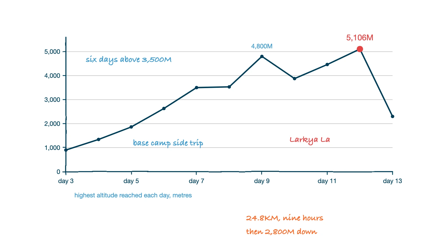
The Manaslu Circuit Trek covers 143.7KM (89 miles) on foot, walking from Machha Khola to Dharapani. The figure covers the trail only. Adding the road transfers at both ends brings the full journey from Kathmandu and back to 520 to 550KM.
| Segment | Distance |
|---|---|
| Walking, Machha Khola to Dharapani | 143.7KM (89 miles) |
| Longest walking day, Dharamsala to Bhimtang over Larkya La | 24.8KM, around 9 hours |
| Driving, Kathmandu to Machha Khola and Dharapani back to Kathmandu | 370 to 400KM |
| Total trip distance, walking and driving | 520 to 550KM |
Terrain and Trek Duration on the Manaslu Trail
Terrain, not distance, sets the trek duration. Below Jagat the trail is a gorge path of stone steps, suspension bridges and landslide crossings that never stays level for an hour. Between Deng and Samagaun it becomes forest and farmland with steady climbing. Above Samdo the terrain turns to moraine, scree and frozen ground, and that last stretch is why the standard itinerary allows 13 to 14 walking days for a distance a road walker would cover in half the time. Operators list the route anywhere from a 13-day Manaslu Circuit Trek to an 18-day version, and the difference between them is almost entirely acclimatisation nights rather than extra kilometres.
Why Walking Hours Matter More Than Kilometres
A flat 20KM at home and a 20KM day on the Manaslu Circuit are not comparable, which is why itineraries here are written in hours rather than kilometres. Below Jagat the trail gains and loses height constantly along the Budhi Gandaki gorge, so a short day on the map is a long day on the legs. Above Samdo the distances shrink and the times stay the same, because at 4,000M a normal walking pace is no longer available. Use the hours column in the itinerary table below to plan your days, and treat the kilometre total as context rather than a schedule.
The Drive to the Trailhead at Machha Khola
The trailhead is about 160KM northwest of Kathmandu at Machha Khola, which replaced Soti Khola as the standard starting point once the road was extended. The drive takes 8 to 10 hours depending on the vehicle and road conditions. The surface is paved as far as Arughat and rough after that.
- Public bus. USD 8 to 15 per person one way, about 10 hours, leaving Gongabu Bus Park between 6:00 AM and 7:00 AM. Be at the bus park by 5:30 AM.
- Private jeep. USD 175 to 250 per vehicle one way, 7 to 8 hours, hotel pickup. A Land Cruiser or similar 4WD carries 6 to 7 people, so a group, its guide and its porters travel together. Ordinary cars cannot pass Arughat.
Best Season for the Manaslu Circuit Trek
Autumn, from late September to November, is the best time to trek the Manaslu Circuit, and spring, from March to May, is the second choice. Both seasons give stable weather and a Larkya La crossing that is passable without winter equipment. Monsoon and winter are possible but neither is recommended for a first visit.
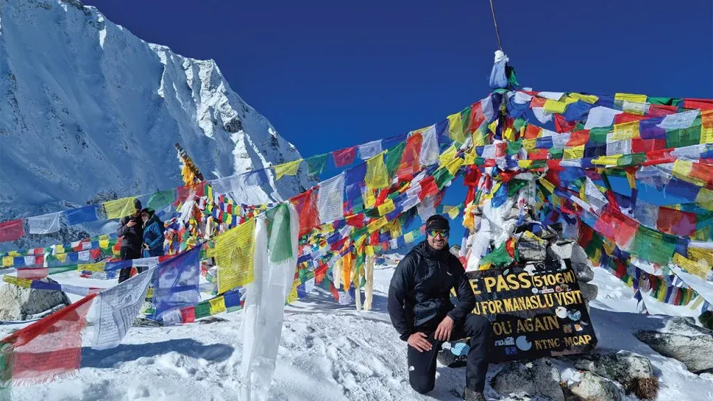
Autumn, September to November
Autumn is the premier season. The monsoon has washed the haze out of the air, so the mountain views are at their sharpest, and daytime temperatures at lower elevations run 10°C to 20°C. October is the most reliable month of the year on this route. Dashain and Tihar fall in this window, so the villages are busy with festivals, and Dharamsala fills up, which is why beds there are booked ahead.
Spring, March to May
Spring brings moderate temperatures and rhododendron forests in flower below 3,000M. Visibility is good but not as sharp as autumn, because pre-monsoon haze builds through late April and May. Snow can still lie on Larkya La in early March. April is the strongest spring month.
Winter and Monsoon
Winter, December to February, is cold and quiet. Larkya La can be snow-covered and dangerous, and many teahouses close or cut services. It suits experienced winter trekkers looking for complete isolation, nobody else.
Monsoon, June to August, brings heavy rain, leeches on the lower trail, landslide risk in the Budhi Gandaki gorge and cloud where the mountains should be. Most agencies do not run the route in these months.
| Season | Months | Difficulty | Ideal For |
|---|---|---|---|
| Spring | Mar – May | Moderate to Challenging | Nature lovers, photographers, and those seeking slightly fewer crowds |
| Autumn | Sept – Nov | Moderate to Challenging | First-time trekkers and cultural festivals (Dashain & Tihar) |
| Winter | Dec – Feb | Extreme | Skilled winter trekkers looking for complete isolation |
| Monsoon | Jun – Aug | Very High | Nature lovers who don’t mind rain and poor visibility |
Day-to-Day Difficulty Breakdown
The standard Manaslu itinerary runs 14 days, beginning with two days in Kathmandu and the drive to Machha Khola on Day 3. Walking hours, not kilometres, are what the trekking days are planned around, and the table below is the day-to-day difficulty breakdown of the whole route.
| Day | Route | Altitude | Walking Hours | Highlights |
|---|---|---|---|---|
| 01 | Arrival in Kathmandu | 1,400M / 4,593FT | Airport transfer, trek briefing, hotel check-in | |
| 02 | Kathmandu Preparation & Sightseeing | 1,400M / 4,593FT | UNESCO World Heritage Sites (Pashupatinath, Boudhanath), permit processing | |
| 03 | Drive from Kathmandu to Machha Khola | 900M / 2,952 FT | ~8Hours (drive) | Drive via Prithvi Highway, first views of the Budi Gandaki valley |
| 04 | Trek from Machha Khola to Jagat | 1,340M / 4,396FT | 6Hours | Budi Gandaki River, Gurung villages, waterfalls |
| 05 | Trek from Jagat to Deng | 1,860M / 6,102FT | 7–8Hours | Dense forests and entry into the Manaslu Conservation Area |
| 06 | Trek from Deng to Namrung | 2,630M / 8,628FT | 6–7Hours | Ghap village, Tibetan culture, Ganesh Himal views emerge |
| 07 | Trek from Namrung to Lho and Shyala | 3,500M / 11,483FT | 4–5Hours | Views of Mt. Manaslu (8,163 m), Himalchuli, Ngadi Chuli |
| 08 | Trek from Shyala to Samagaun | 3,530M / 11,581FT | 4–5Hours | Pungen Glacier views, Tibetan Buddhist culture, mani walls |
| 09 | Acclimatization at Samagaon / Side trip to Manaslu Base Camp | 4,800M / 15,748FT | 7–8Hours (optional) | Manaslu views, glaciers, Birendra Lake (3,691M) |
| 10 | Trek from Samagaun to Samdo | 3,875M / 12,713FT | 2–3Hours | Short acclimatization day, Tibetan border views, yak pastures |
| 11 | Trek from Samdo to Dharamsala (Larkya Phedi) | 4,460M / 14,633FT | 3–4Hours | Final camp before Larkya La Pass |
| 12 | Trek from Dharamsala to Larkya La Pass and Bhimtang | 5,106M / 16,752FT | 8–9Hours | The highest point of the trek, 24.8KM, cross into the Marsyangdi valley |
| 13 | Trek from Bhimtang to Dharapani | 2,300M / 7,546FT | 5–6Hours | Rhododendron forests, Marsyangdi River valley |
| 14 | Drive from Dharapani to Kathmandu | 1,400M / 4,593FT | ~8–9Hours (drive) | Return drive, trek completion celebration |
Altitude Sickness and Acclimatisation
Altitude sickness happens when the body does not adjust fast enough to the lower oxygen levels at height. The common form is Acute Mountain Sickness (AMS), which feels like a strong hangover: headache, nausea, dizziness and tiredness. HAPE and HACE are rarer and dangerous. HAPE affects the lungs and causes severe breathlessness even at rest, while HACE affects the brain and shows as confusion, poor balance and behaviour that is out of character.
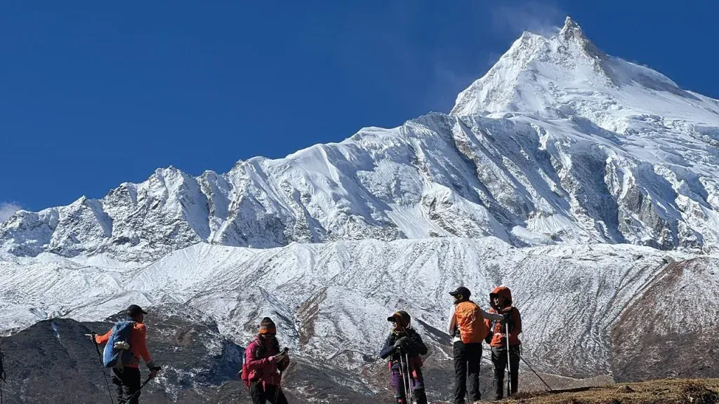
The practical measures on this route are the same every day. Gain no more than 300 to 500M of sleeping altitude per day above 3,000M. Drink 3 to 4 litres of water daily. Eat properly, and dal bhat with free refills is the cheapest way to do it. Take the rest days at Samagaun and Samdo seriously, because they are the two nights that carry you over Larkya La. Some trekkers take preventive medication on medical advice, but pace and honesty about symptoms do more than any tablet.
Teahouses, Food and Cold on the Trail
Teahouses on the circuit serve Nepali, Tibetan and simple Western food. Dal bhat (rice, lentil soup, vegetable curry and pickles, with free refills) is the staple, alongside thukpa, momos, Tibetan bread, pasta, fried rice and pancakes.
Rooms are basic: twin beds, thin mattresses, shared bathrooms and no heating. The dining hall with its stove is the only warm room in the building, which is why evenings are spent there. Hot showers, Wi-Fi and device charging all cost a small fee and are available in lower villages such as Namrung and Samagaon, then thin out towards Dharamsala, where the temperature at night is the main thing on anybody's mind. Dharamsala has only a few lodges with limited beds, so in October and April a guide who has called ahead is the difference between a bed and the dining hall floor before the hardest day of the trek.
How to Make the Manaslu Circuit Trek Easier
There is no way to shorten the pass, but there are four honest ways to make the trek easier, and every one of them is a decision taken before you leave Kathmandu.
- Add a day. A 15 or 16 day version with a second night at Samagaun or an extra night at Namrung is the single most effective way to manage the difficulty. Most trekkers complete the circuit comfortably for one reason only: they walked it slowly.
- Hire a porter. Carrying 5KG instead of 12KG changes the last two hours of every day. It is the cheapest comfort on the whole trip.
- Use trekking poles. They take load off the knees on the 1,400M drop from Larkya La to Bhimtang, which is where the descent hurts.
- Pick October or April. Warm enough, dry enough and a pass with no deep snow on it. Season choice does more for how the trek feels than any amount of gear.
None of these make the Manaslu Circuit Trek easy. They make it manageable, which is a different and more useful thing. Conquering the Manaslu Circuit is less a matter of strength than of pacing, and the difficulty of the Manaslu Circuit drops sharply the moment you stop trying to save a day.
Permits and Guide Rules in Short
The Manaslu restricted area begins at Jagat. Three permits are required, a licensed guide is mandatory, and the paperwork must be filed by a registered trekking agency rather than by you. An experienced guide is not only a legal requirement here but the single thing that makes the trek safer, because the remoteness of the Manaslu side of Gorkha District leaves navigation, weather calls and bed bookings at Dharamsala to one person. Walking Manaslu safely is largely a matter of who is walking in front of you.
- Restricted Area Permit (RAP), issued by the Department of Immigration for the Jagat to Dharapani section.
- Manaslu Conservation Area Permit (MCAP).
- Annapurna Conservation Area Permit (ACAP), which covers the Bhimtang and Dharapani side of the pass.
TIMS cards are not required on this route. Since March 2026 a single trekker can be issued the RAP, so the old minimum of two trekkers no longer applies. Fees by season, SAARC rates and the full cost breakdown are set out in the Manaslu Circuit Trek permit and cost guide, and what the rules mean if you are travelling alone is covered in the Manaslu Circuit Trek solo guide.
Manaslu Circuit Difficulty vs the Annapurna Circuit Trek
Both routes cross a high pass and both take you through traditional villages, but they are not equally hard. Larkya La is 310M lower than Thorong La, yet the Manaslu Circuit is the more demanding trek because it runs longer, keeps you further from a road, and carries no jeep track to bail out onto.
| Factor | Manaslu Circuit | Annapurna Circuit |
|---|---|---|
| Difficulty | Strenuous | Moderate |
| Duration | 14 to 18 days | 10 to 12 days |
| Highest point | Larkya La Pass (5,106M) | Thorong La Pass (5,416M) |
| Crowd level | Low | Very High |
| Guide required | Yes, mandatory by law | No, independent trekking is fully allowed |
| Permits required | RAP + MCAP + ACAP | ACAP + TIMS |
| Road access on the trail | Minimal | Significant |
| Cultural immersion | Nubri and Tsum Tibetan-origin communities | Diverse, Gurung, Thakali, Manangi, and Tibetan villages |
If you want the same length of trek with less altitude and no restricted-area paperwork, the Annapurna Circuit Trek is the easier of the two. If you want the pass day and the quiet, Manaslu is the one. Judged on the Manaslu trek difficulty alone, it is the harder circuit trek in Nepal of the pair, and most trekkers who complete the circuit say the extra days are what made it worth doing.
Plan the Larkya La Crossing
Trekking the Manaslu Circuit rewards people who train for the pass day and walk with guides who know the route. What the Manaslu Circuit demands is patience with the schedule, not bravery. Himalayan 360 runs the circuit as a fully guided trip with permits, a licensed guide, teahouse accommodation and road transfers from Kathmandu included, and our guides walk this trail every season.
If you plan to book the Manaslu Circuit Trek in 2026, fix your dates first. Autumn departures and the beds at Dharamsala both go early, and a Himalayan adventure of this length is easier to build a training plan around when the date is already in the diary.


14 Days
Manaslu Circuit Trek
$920
5.0(7 reviews)
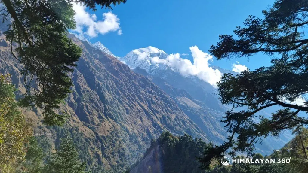
The Manaslu Circuit Trek is a stunning 13-18 day teahouse trek in Nepal, circling the world’s 8th highest mountain (Manaslu 8,163m), and covers about 144KM (89 Miles). The trek journey starts at Machha Khola and slowly climbs through farmlands and small villages. As you move higher, you reach mountain valleys like Samagaon and Samdo. The biggest highlight is crossing the Larkya La Pass (5,160M), where you can see amazing views of Manaslu, Himalchuli, and Ngadi Chuli. The trek also offers a local culture experience. Villages such as Samagaon, Namrung, Lho, and Deng show strong Tibetan traditions. You will see monasteries, prayer flags, and mani walls along the way. Depending on the season, you may also witness festivals like Lhosar (Tibetan New Year) or Saga Dawa, which celebrates Buddha’s life. In these villages, people farm millet, herd yaks, and live in ways passed down for centuries. This gives trekkers a close look at a culture that is still very traditional. The Manaslu Circuit trek trail also takes you through different natural landscapes. In the lower region at Jagat and Soti Khola, you will walk through green forests alive with rhododendron, magnolia, and bamboo. As you go higher past Philim, Namrung, and Samdo, the forest changes into oak, maple, and conifers, with waterfalls along the way. Near Samagaon and Larkya La, the land becomes rocky and snowy, with only small plants like moss and lichens. The changing landscape offer the true trekking experience throughout the Manaslu Circuit trek. Likewise, one special thing about the trek to Manaslu Circuit region is that it is a restricted area. Trekkers need special permits, which help protect the environment and keep the trail less crowded. You will need to compulsorily hire a trekking guide. You can find simple teahouses and lodges in main villages, but the trek still feels wild and quiet compared to other popular routes in Nepal. The best time for Manaslu Circuit trek is during the Spring (March to May) and Autumn (September to October) seasons.


20 Days
Manaslu Tsum Valley Trek
$1,330
The Manaslu Tsum Valley Trek is an adventure around Mount Manaslu, the world’s eighth-highest peak at 8,163 meters (26,781 feet). This trek takes you through the scenic Manaslu Conservation Area and into the remote Tsum Valley, close to the Tibetan border. For 20 days, trekkers travel through serene pine forests, rhododendron jungles, and challenging trails leading up to the Larkya La Pass with majestic mountain views. The trek features high-altitude lakes, unique wildlife, and ancient Buddhist monasteries, with altitudes above 3,000m and 5,000m (16,404 feet) respectively. Along the way, you’ll discover a rare blend of Nepali and Tibetan culture, language, and traditions that make this region truly special. You will climb through Gurung villages with rice and millet terraces and cross many Buddhist shrines, especially in the Tsum Valley, which also has a similar culture to Tibetans. Tsum Valley, located near the Tibetan border, offers opportunities to encounter Buddhist monks and explore Milarepa’s Cave. You can also view Nepal’s national bird, the Lophophorus, against majestic landscapes of Mount Manaslu and Himalayan ridges like Hiunchuli and Annapurna II. The Manaslu Tsum Valley trek is ideal for adventure-seekers, but beginners with strong bodies and amazing stamina can also experience this. Just make sure that you are physically fit, if you are planning to take up the trek.
 Trek
Trek By air
 Pilgrimage
 Festivals
 Wildlife
 Luxury
 Yoga
Yoga Food
Food Heritage